

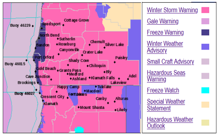
Virtually all of southern Oregon and northern California are under some level of weather warning or advisory from the National Weather Service after holiday storms released inches of rain and feet of snow in some locations across the region.
Travel conditions will be difficult through Monday morning with record cold lows and cold maximum high temperatures possible into mid-week. All area passes and most valleys will be affected as snow levels will occasionally dip to sea level mostly during night time and early morning hours. Chances of precipitation will continue into Monday and early into the work week, however, low temperatures are expected to get very low as a trough of very cold air from the Gulf of Alaska moves into the region.
Travel continues to be strongly discouraged through Monday morning as precipitation chances dissipate and frigid air freezes standing snow and ice already accumulated on roadways. However if you must travel, you are encouraged to bring blankets, medications, food, water, flashlight, tire chains, and a fully charged cell phone as conditions could unexpectedly close passes, leaving travelers stuck in traffic for an extended period of time.
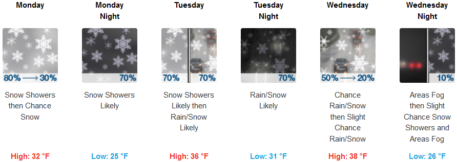
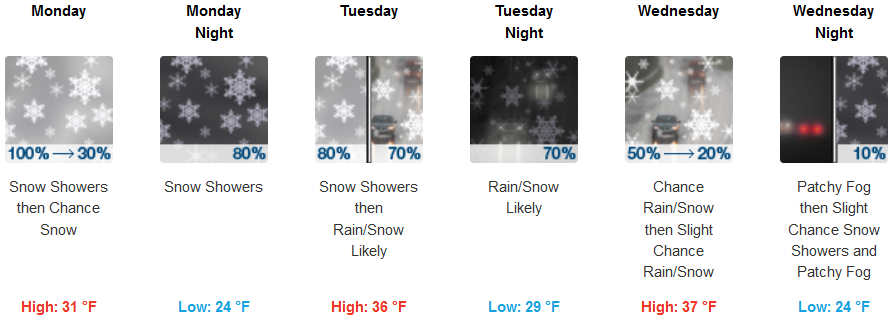
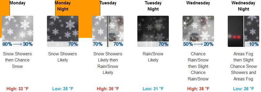
Inland areas are forecast to experience an influx of frigid air to take temperatures well below normal to begin the work week. Snow showers and very cold air are forecast to continue through mid-week with chances of precipitation decreasing as the work week progresses. High temperatures are expected to stay very cold reaching only the low to mid 30’s, with lows in the mid to low 20’s.
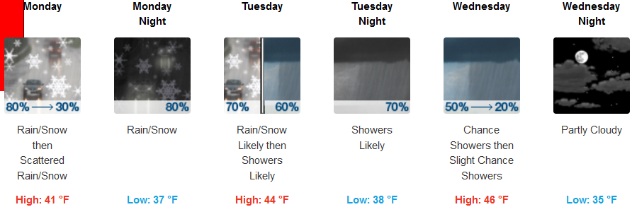
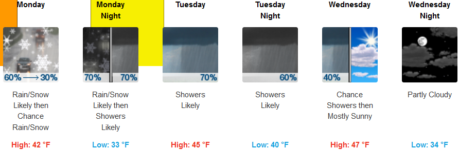
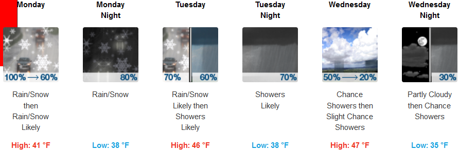
On the coast, precipitation is expected to continue with the possibility of a slight break Wednesday morning before another round of showers begin late Wednesday and early Thursday. Early in the week, chances of snow showers before 7:00am continue, followed by rain and snow showers and possible thunder is also possible as colder air pushes in, dropping snow levels to 300 feet. High temperatures could reach the mid 40’s in some areas, with low temperatures in the mid 30’s.
Brookings:
Crescent City:
Gold Beach:
Cave Junction:
Grants Pass:
Medford: