

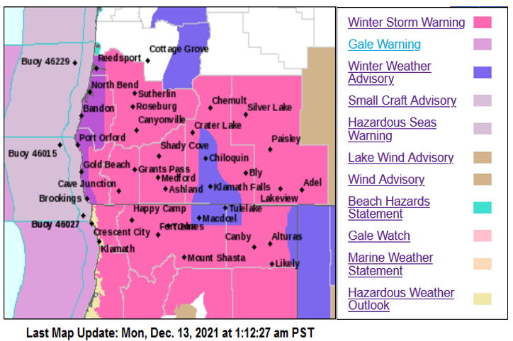
Gale Warnings off the coast have generated High Surf Warnings pn beaches along the southern Oregon and northern California coastlines while an upper level storm system will continue to direct a plume of moisture into the area.
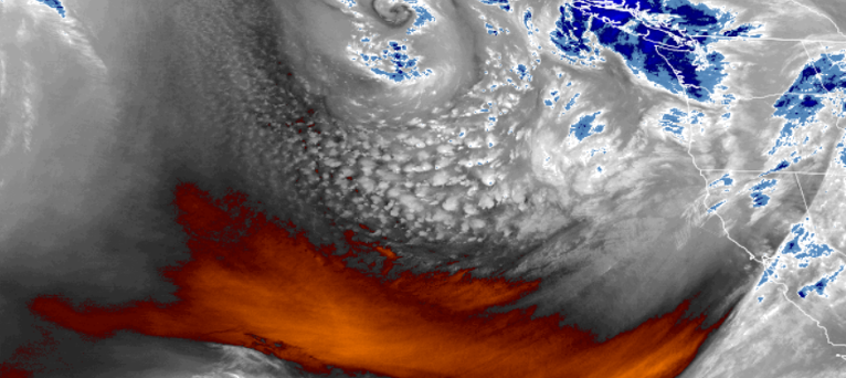
Cold air is associated with this system, dropping temperatures very low in localized areas. The developing upper-level low is forecast to begin to move
onshore over the Pacific Northwest overnight Monday into Tuesday, and continue to produce coastal rain and higher elevation snow, before slipping to the south as the work week progresses.
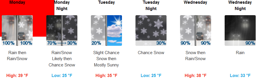
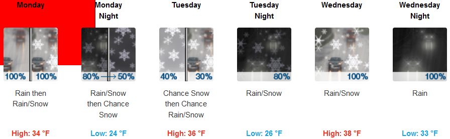
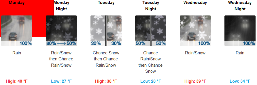
Inland Winter Storm Warnings and Winter Weather Advisories have been issued by the National Weather Service for much of the southern Oregon and northern California region through Monday, focusing on heavy snow expectations with snow accumulations of 1 to 3 inches above 1500 feet. Rain is expected by late afternoon, then rain and snow likely with the snow level dropping to 2500 ft. Temperatures will remain very cool for the work week, with lows in the mid 20’s by mid week and highs only reaching the upper 30’s throughout the work week.
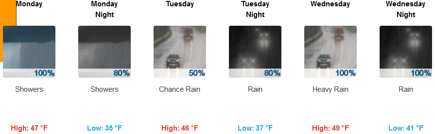
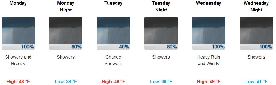
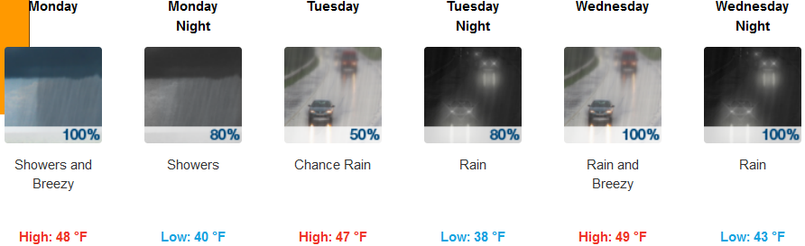
Along coastal areas, early Monday will see cold air moving into area, possibly producing localized thunderstorms in some areas as the cold air pushes the warmer air from the last system off to the east. Rain is likely early in the day, continuing through Tuesday before the colder moisture moves over the area bringing more precipitation. Temperatures will be much milder than inland areas with lows in the upper 30’s mid week, and highs in the upper 40’s.
Brookings:
Crescent City:
Gold Beach:
Cave Junction:
Grants Pass:
Medford: