

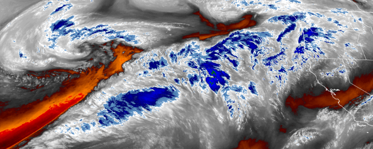
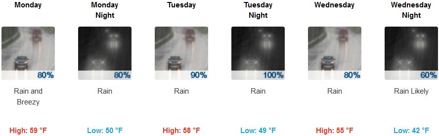
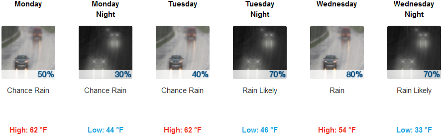
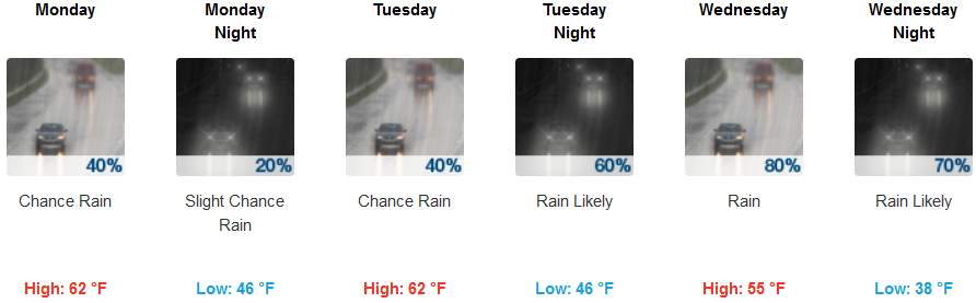
A shift in the weather pattern is proving to be responsible for this recent round of precipitation that began Sunday for most locations, and appears to have opened a pattern of systems collecting moisture from warmer waters in the mid Pacific. As this new pattern churns low pressure systems into the Pacific northwest, periods of rain followed by unsettled weather is forecast for the first part of the work week.
A system off of southern California is currently keeping bulk of the weather pattern just to the north, and although significant chances for precipitation continue in the Medford area through out the week, chances of rain decrease for more southerly locations.
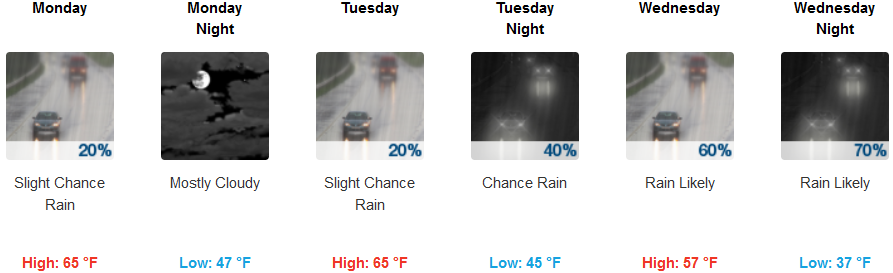
Inland, rain is likely across the southern Oregon region through out the work week with chances increasing for more northern locations initially, increasing chances for more southern areas as the system moves to the east and reaches further south. Temperatures will be considerably warmer compared to the past week with lows only reaching the mid 40’s and highs getting to the low 60’s.
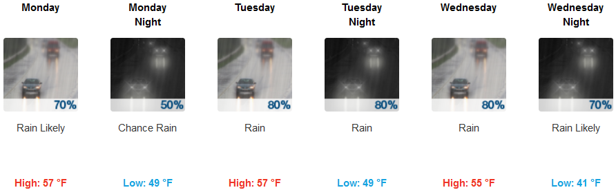
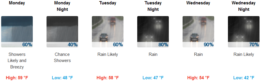
Along coastal areas, rain is expected everyday early in the work week, with chances decreasing for more southern areas. Even with a slight south wind possibly reaching 10 mph, temperatures are forecast to be extremely mild, with coastal lows in the upper 40’s and highs in the upper 50’s possible.
Brookings:
Crescent City:
Gold Beach:
Cave Junction:
Grants Pass:
Medford: