

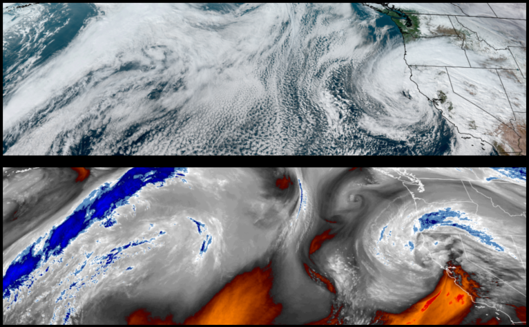
The strong low pressure system that was circulating off the coast of northern Oregon and Washington has now pushed to the south and will continue to circulate precipitation into the region as the atmospheric river of moisture from warm air extending into the Pacific continues to saturate California.
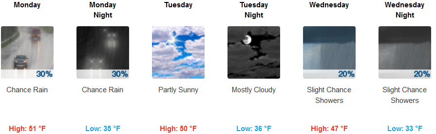
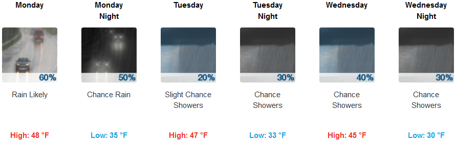
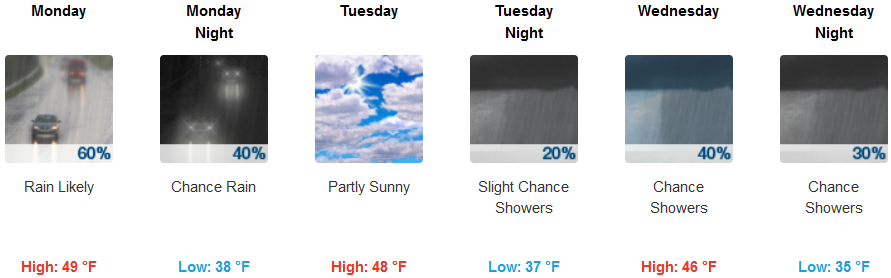
Rain is forecast to continue inland, into late Monday before a brief clearing and partly cloudy skies Tuesday as waves of weak weather systems circulate showers into the region through midweek. Temperatures are expected to stay cool as another low pressure system circulates cold unstable air into the region keeping temperatures in the mid to low 30’s and highs in the mid to upper 40’s.
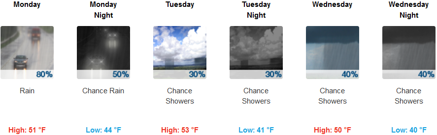
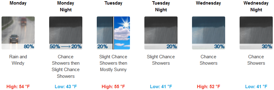
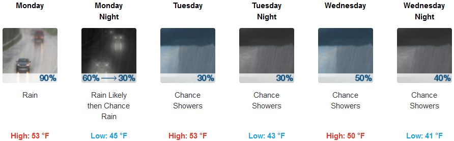
Along the coast rain and localized showers are forecast to continue into Tuesday as the top edge of the atmospheric river pushing into California brings wet weather to southern Oregon through midweek. Temperatures along the coast will be mild with lows in the mid to low 40’s and highs in the low 50’s.
Brookings:
Crescent City:
Gold Beach:
Cave Junction:
Grants Pass:
Medford: