


Storms are lined up across the Pacific Ocean, and the storm track will bring them right into the area this weekend and into next week. Say goodbye to the stable air, and hello to wind, rain & snow as the pattern turns more active from Friday night onward. If you have travel plans Saturday and/or Sunday, be prepared for difficult driving conditions due to heavy snow and strong winds.
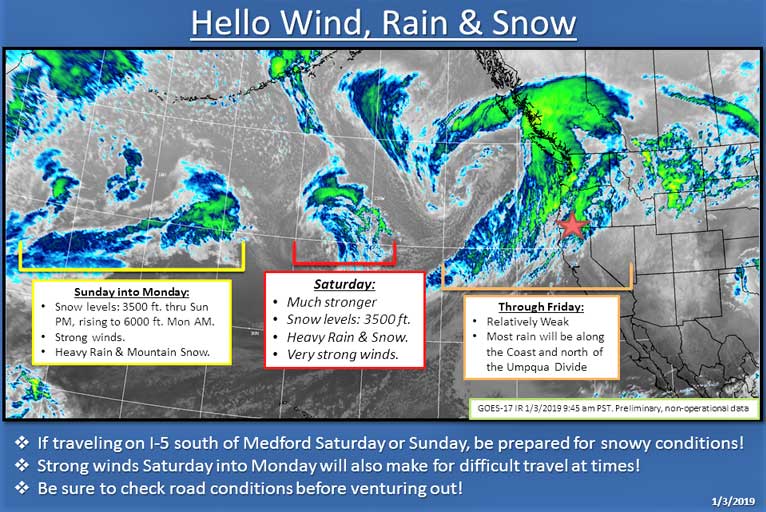
A strong low-pressure system will move through the area Saturday, bringing heavy rain, snow & strong winds. The trajectory of the low favors strong winds in the Shasta Valley which will enhance precipitation.
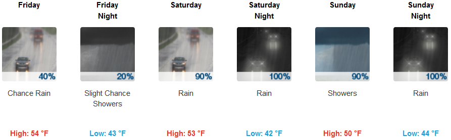
Brookings:
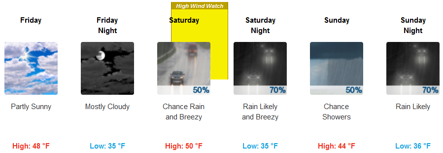
Medford:
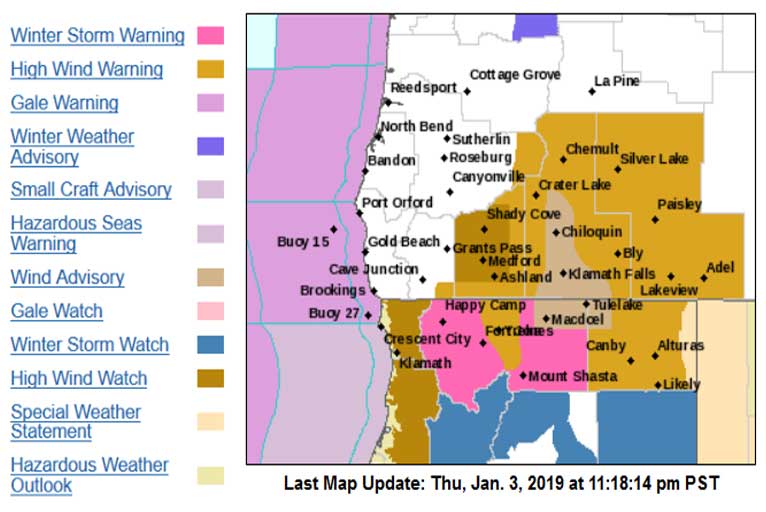
Snow levels will be down to 3500 feet, and at times lower to 3000 feet during heavy precipitation. A Winter Storm Watch is in effect from 4 am Saturday through 10 pm Saturday and includes Mount Shasta City, Snowman’s Summit.
A more substantial system will then approach on Saturday, with more widespread rain. Rain will likely be heavy at times. Portions of the Oregon coast and northwest California may see strong winds. Additionally, cold air trapped in the eastern valleys may keep snow levels as low as 2,500 to 3,000 on Saturday, with several inches or more of snowfall possible. Additional storm systems are expected Sunday into early next week.
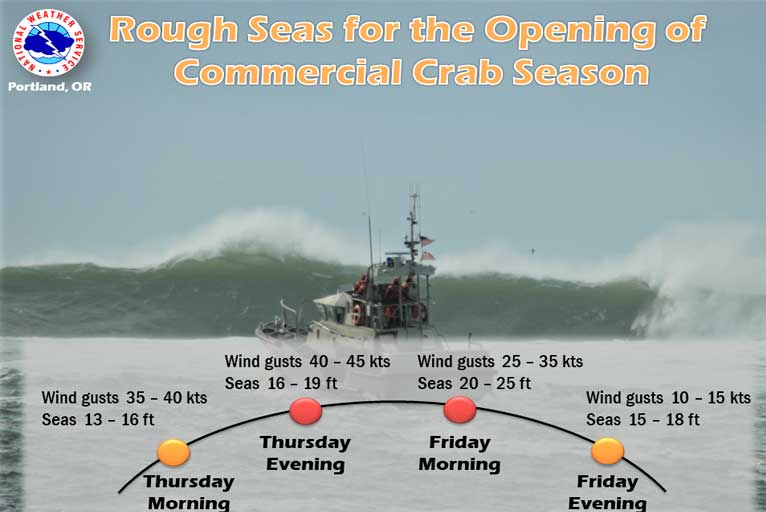
The upcoming storm will make for rough seas for the opening of commercial crab season on Friday. Gales for most of the day were forecast on Thursday, with seas peaking Friday morning around 20 to 25 feet. Southerly winds gusting 30 to 40 mph along exposed sections of the coast. Locally 50 to 60 mph wind gusts could occur at higher elevations.
Please Like, Share and Follow the …
![]()