

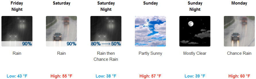
The transition to fall weather will be in full swing this weekend as the late summer weather pattern we have been enjoying move to the east. Wetter weather with rain totals reaching 0.50-1.50 inches could be expected across much of Oregon and northern California as soon as this evening, Friday, October 21st.
A strong cold front is forecast to move into inland areas and continue throughout the weekend with below normal temperatures across most of the southern Oregon region. Cloudy skies will continue into Friday evening, ushering in wet weather throughout the area with high temperatures only reaching the low 60’s by Saturday and lows in the low to mid 40’s.
Coastal areas should expect partly sunny skies to start Friday, with an 8 to 13 mph northwest wind that could gusts as high as 21 mph. Rain expected to begin Friday night and continue through out the weekend. High temperatures are expected to drop the mid 50’s with lows in the mid 40’s.
Brookings:
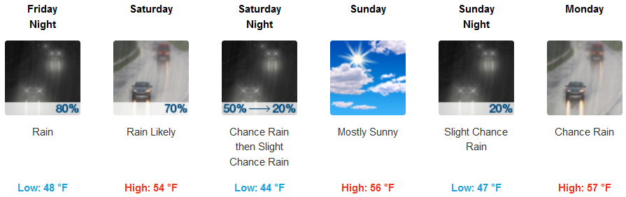
Crescent City:
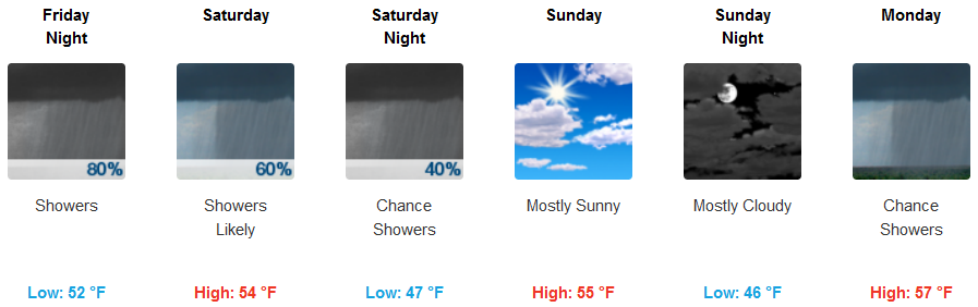
Gold Beach:
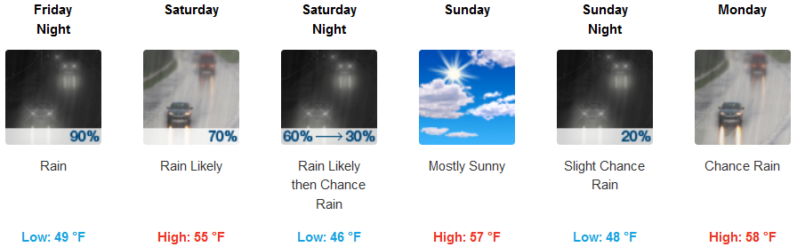
Cave Junction:
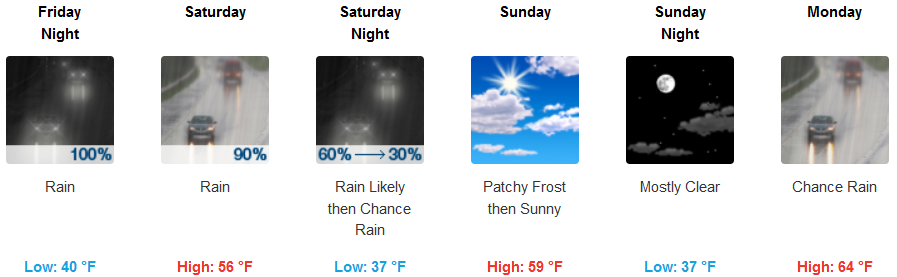
Grants Pass:
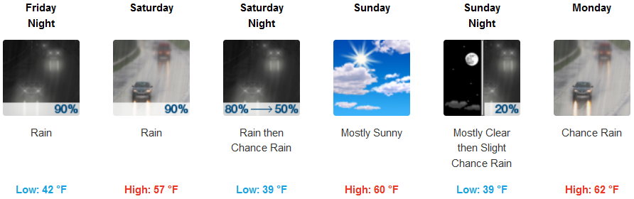
Medford: