

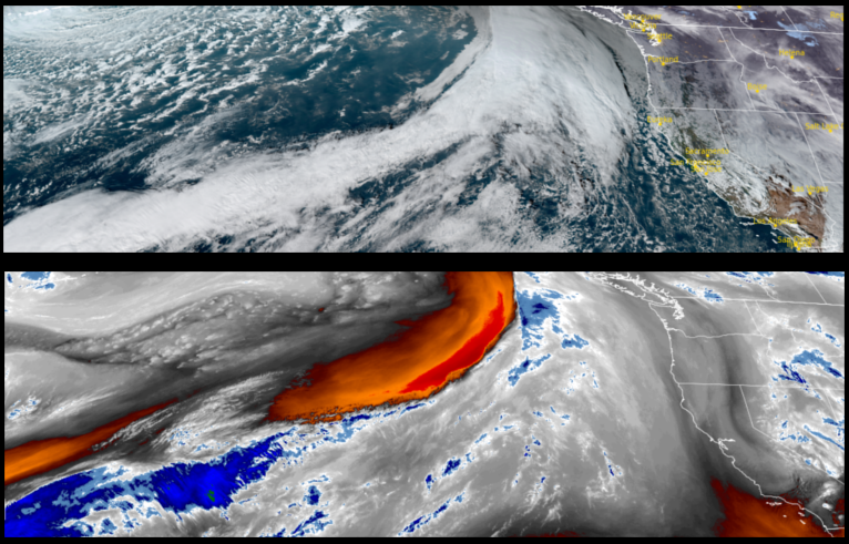
A powerful storm system is forecast to move across the region as early as Thursday bringing cold temperatures, rain and possibly snow down to 2000ft. with another system expected to impact the area Sunday.
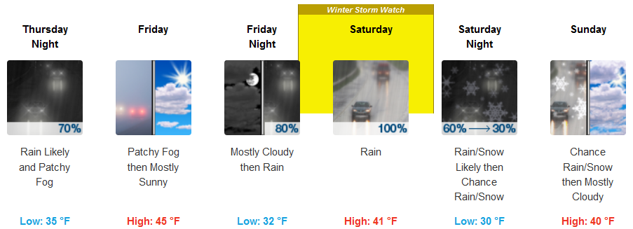
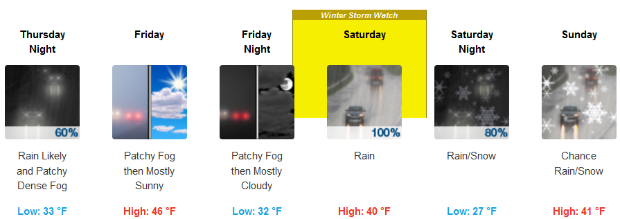
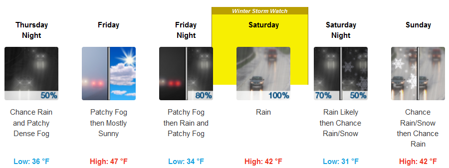
Inland areas are forecast to see rain beginning Thursday morning, before clearing as another system moves in Saturday and Sunday with more precipitation and low elevation snow forecast. Low temperatures are expected to be in the low 30’s, with afternoon highs only reaching the low to mid 40’s.
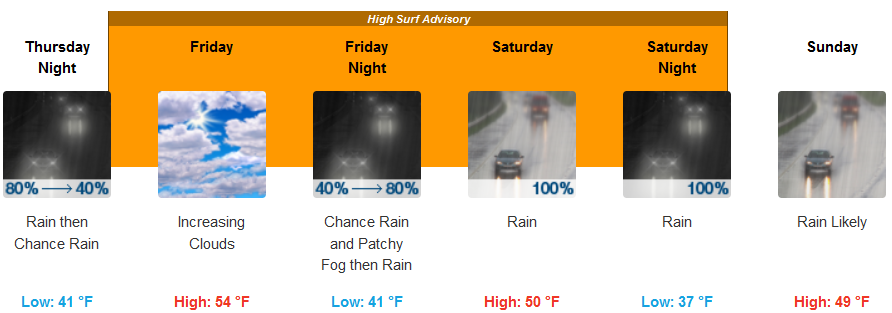
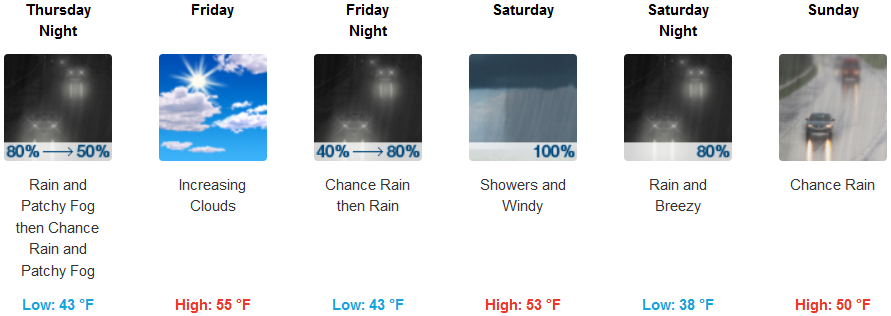
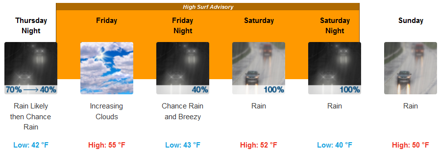
On the coast, rain is expected to begin very early Thursday morning, continuing into Friday before the next system works its way onshore early Saturday with more rain through Sunday. Temperatures will remain comparatively mild with lows in the low to mid 40’s and highs getting to the low to mid 50’s.
Brookings:
Crescent City:
Gold Beach:
Cave Junction:
Grants Pass:
Medford: