

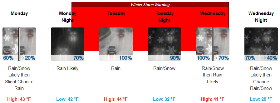
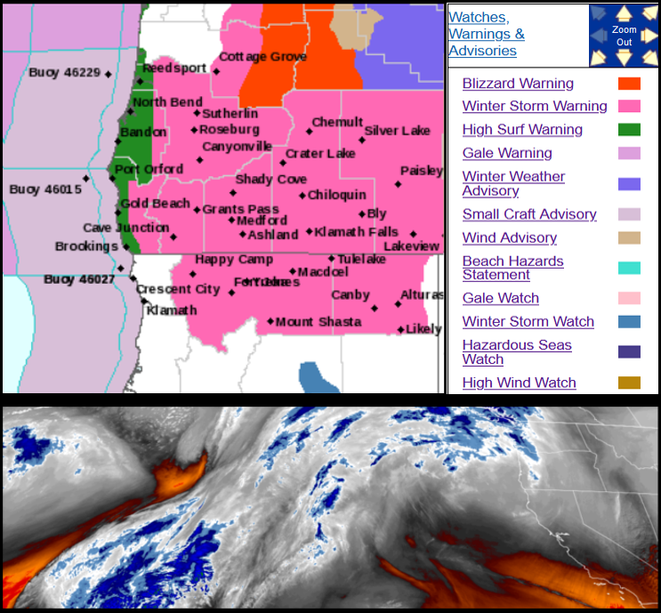
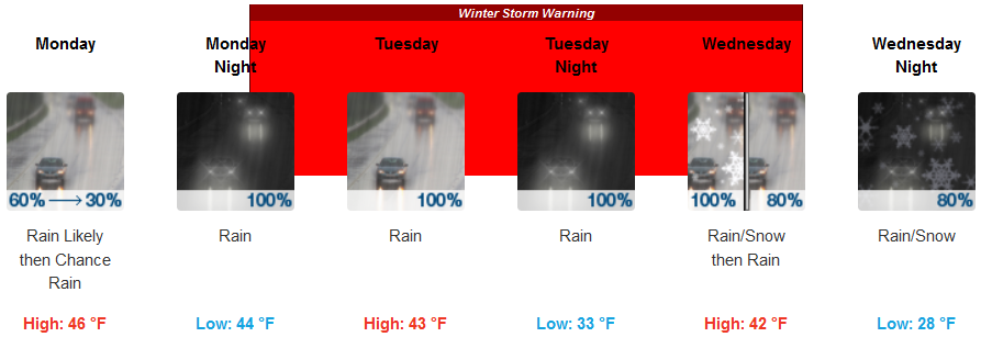
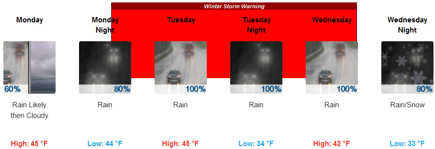
The substantial low pressure systems that have been circulating off the coast for the past several days are forecast to move onshore starting very early Monday morning, bringing rain to much of southern Oregon and northwestern California with a short break before another powerful colder system moves in Tuesday prompting Winter Storm Warnings from the National Weather Service across much of southern Oregon including Blizzard Warnings to the northeast including the cities of La Pine and Sunriver.
Inland areas are forecast to see rain as early as Monday morning, with snow levels down to approximately 2300ft. Precipitation is expected to continue Monday as another weather system moves in with wind gusts up to 30mph and even colder temperatures by mid-week. Low temperatures will be in the mid to low 30’s to start the week falling into the upper 20’s late Wednesday.
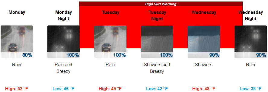
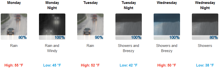
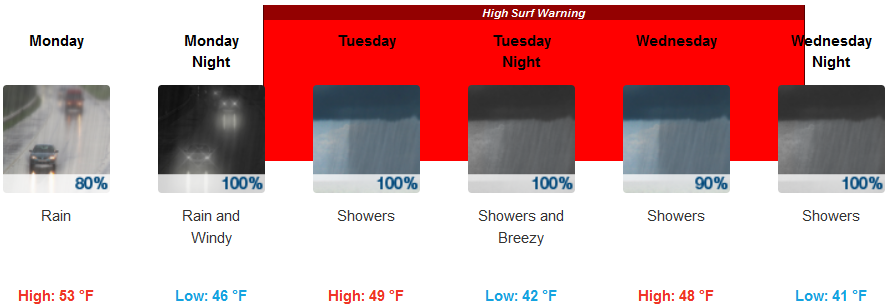
Coastal regions are expected to experience the effects of the two powerful systems moving into the area from the north with rain and winds gusting up to 30mph as early as Monday morning with High Surf Warnings issued up and down the coast from the National Weather Service before another strong storm arrives Tuesday morning with moderate to heavy rain and gusty winds at the coast. Temperatures will range from the low to mid 40’s with highs only getting to the upper 40’s to the lower 50’s.
Brookings:
Crescent City:
Gold Beach:
Cave Junction:
Grants Pass:
Medford: