

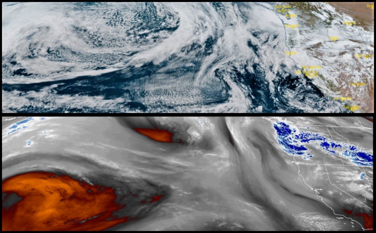
With weather circulating up from a system in the southwest pushing into a low pressure front off the coast circulating down from the north, is expected to bring unsettled weather with chances of rain, lightning and snow at the very highest elevations through the end of the work week and weekend.
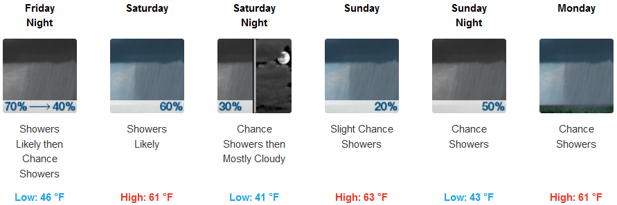
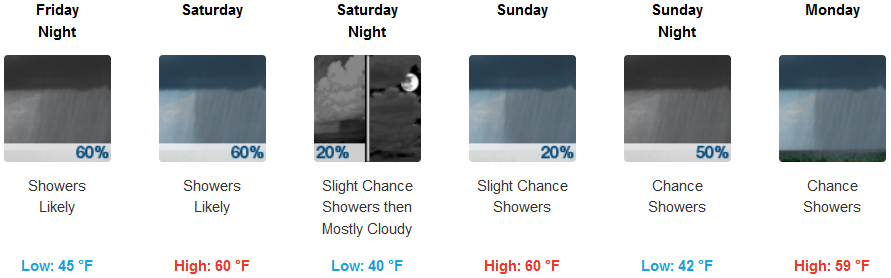
Inland areas will see chances of precipitation and localized rain beginning Friday and continuing through the weekend. Although there are not high percentages for rain, rain is expected. Temperatures will remain moderate through the weekend with lows hovering in the low to mid 40’s and highs in the low 60’s.
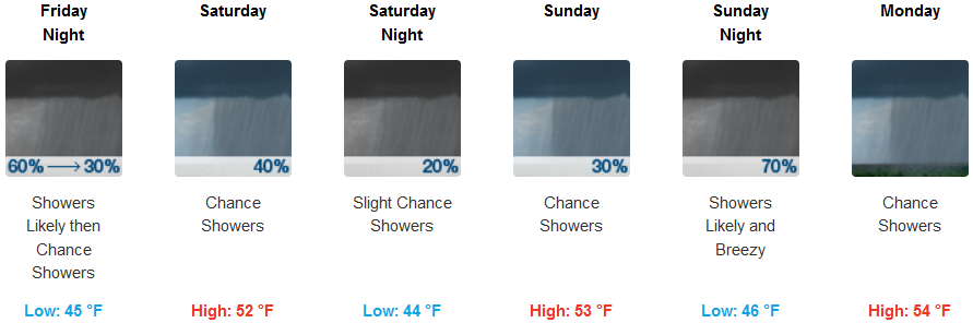
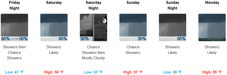
Along the coast rain is forecast sporadically through the weekend with the possibility of a short break Saturday with chances of precipitation increasing late Sunday and into Monday. Temperatures will fluctuate very slightly with lows in the mid to upper 40’s, and highs only getting to the low 50’s.
Brookings:
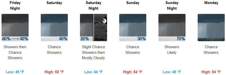
Crescent City:
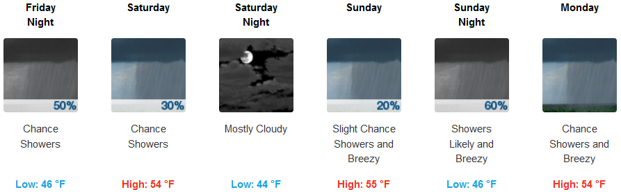
Gold Beach:
Cave Junction:
Grants Pass:
Medford: