

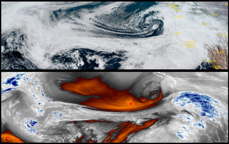
A much warmer air mass has begun to move on-shore circulating a series of moderate to heavy rain across the region with up to 7 inches of precipitation forecast through Monday. Warmer temperatures have prompted the National Weather Service to issue Winter Weather Advisories for much of southwest Oregon, and Flood Advisories along much of the southwestern and northern California coastlines.
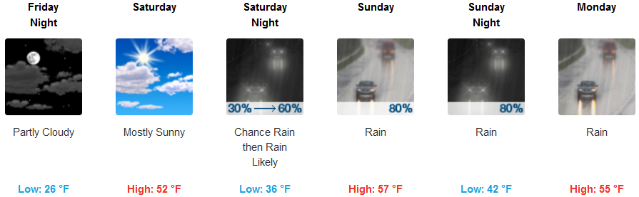
Inland, areas are forecast to see heavy precipitation with snow levels rising and rain falling on low to mid elevation snow which could lead to rapid snow melt causing flooding. Skies could partially clear late Friday and into Saturday before more precipitation begins Sunday. High winds are also associated with this front with wind gusts up to 37mph and higher nearing Shasta. Temperatures are expected to rise into the mid 30’s for lows, with highs reaching the upper 50’s by the end of the Weekend.
With the warmer temperatures associated with this front over the Pacific Northwest, rain falling on low to mid elevation snow is expected to rapidly melt snow packs and combined with heavy rain are expected to overwhelm streams and rivers, forcing the National Weather Service to issue Flood Advisories along much of the southwestern and northern California coastlines. Strong winds with gusts over 40mph could impact coastal areas throughout the weekend. Temperatures will be considerably warmer with lows in the mid 40’s and highs reaching the mid 50’s.
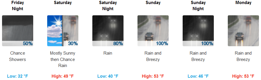
Brookings:
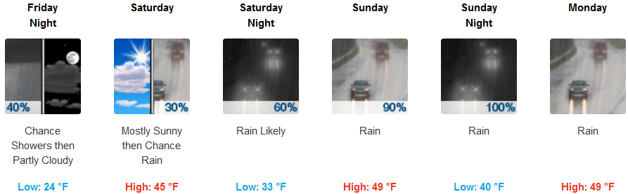
Crescent City:
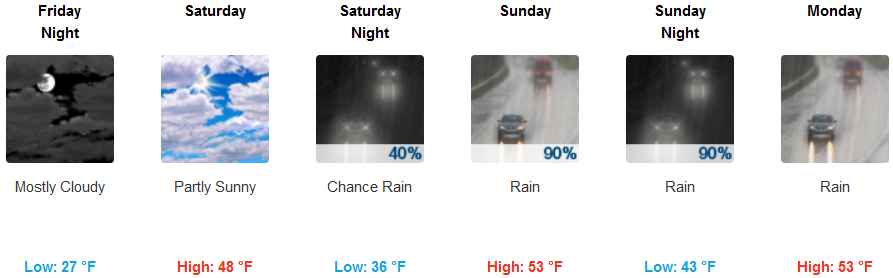
Gold Beach:
Cave Junction:
Grants Pass:
Medford: