


Strong low pressure currently less than 500 miles to our southwest will move along our coast Saturday and produce widespread strong winds over our area as well as heavy snow in the Mt. Shasta area. Please prepare and plan accordingly. This will be followed by another potentially dangerous storm Sunday.
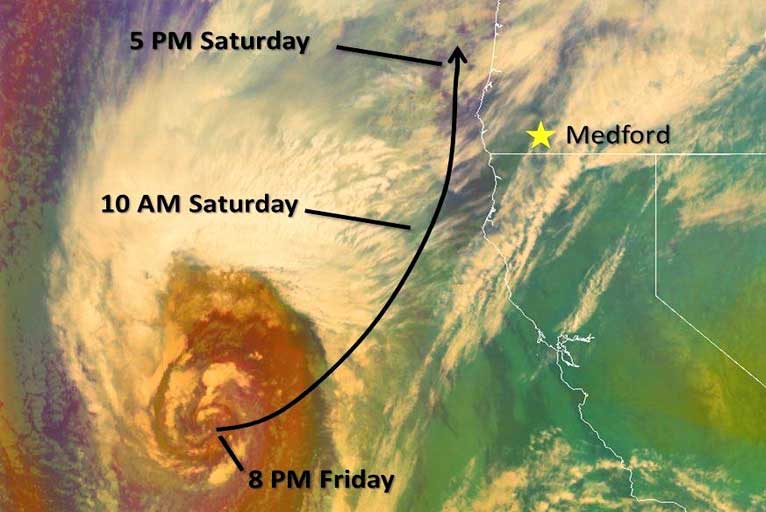
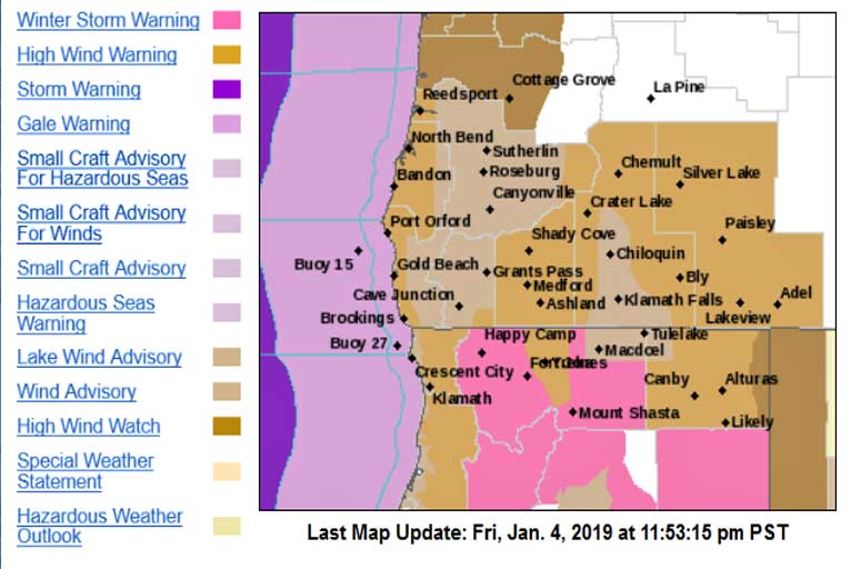
This strong low pressure system will move through the area Saturday, bringing heavy rain, snow & strong winds. The trajectory of the low favors strong winds across the whole region. Wind Advisories and High Wind Warnings are in effect from 4 am through 10 pm.
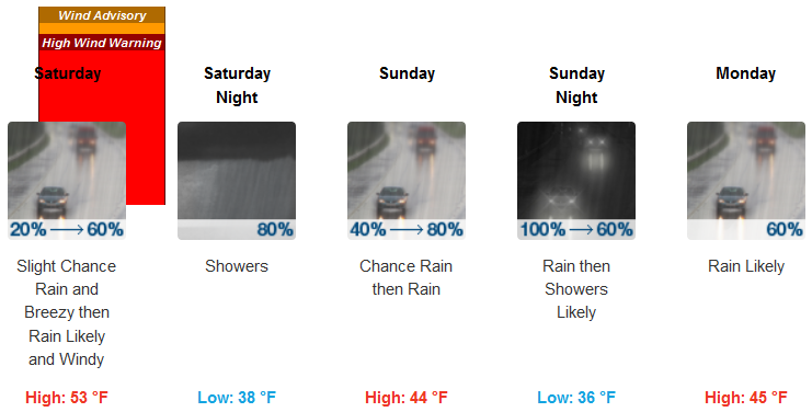
Brookings:
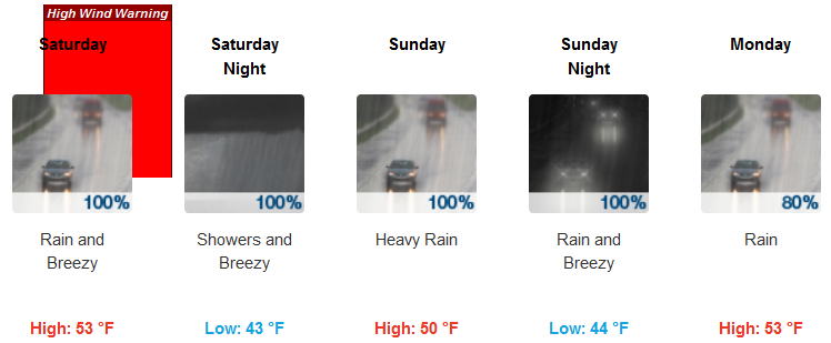
Medford:
The latest information is showing the potential for widespread strong and potentially damaging winds are on track for Saturday! Please pay attention to the latest warnings, advisories, and forecasts for our area.
Note: the track of the low pressure is for your information only. Please do not focus on the exact track – impacts from winds will be felt well inland from the low on Saturday.
Please Like, Share and Follow the …
![]()