

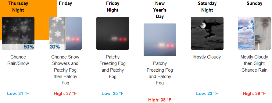
A freeze warning has been put into effect for much of the southern Oregon and northern California coastal areas from Reedsport, Oregon stretching down through northern California beyond Eureka. This recent batch of very cold air also prompted Winter Weather Advisories regarding snow accumulations of 2 to 6 inches in some areas and for much of the valley including Grants Pass and Medford.
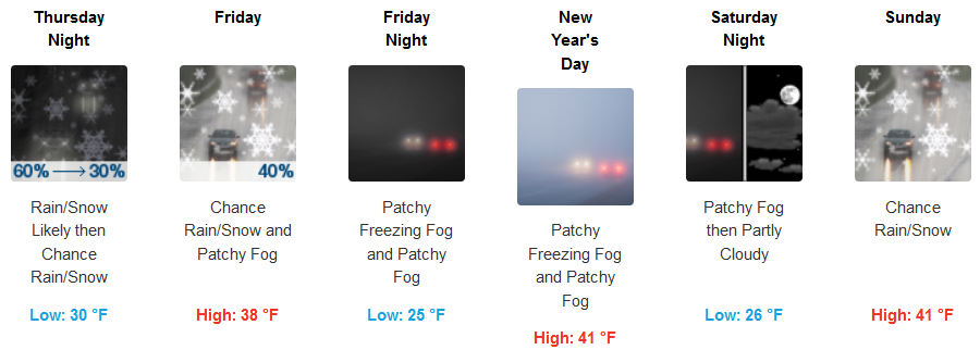
Inland areas are expected to experience continued very cold temperatures and snow accumulations through out the region as snow levels drop to 2000 ft. Rain, snow and freezing fog are forecast to continue through Friday, with a pause in precipitation Friday evening, before more chances of precipitation begin Sunday. Temperatures will be very cold, with lows into the New Years weekend in the upper 20’s and highs only reaching the low 40’s.
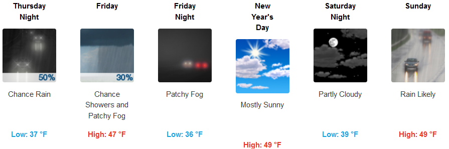
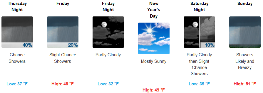
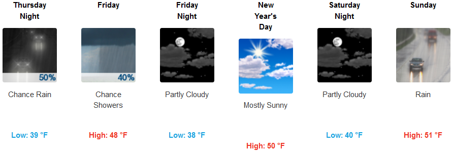
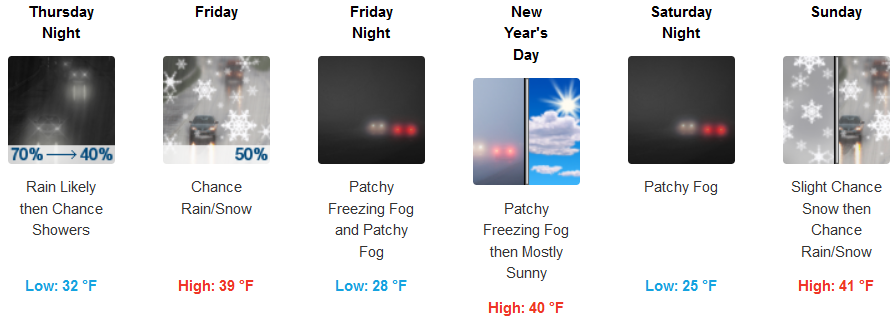
Freeze Warnings along coastal areas will expire late Thursday, however, cold temperatures will continue through the weeks end. Precipitation is forecast to continue into Friday, with partly cloudy skies moving into New Year’s Day. Temperatures along coastal areas are forecast to remain cold, slightly warming going into Sunday. High temperatures in the area will rise to the mid to upper 40’s over the weekend, with lows in the upper 30’s increasing to the low 40’s as the week progresses.
Brookings:
Crescent City:
Gold Beach:
Cave Junction:
Grants Pass:
Medford: