


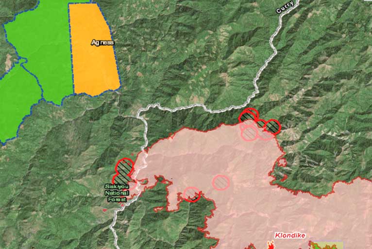
The Klondike Fire added 5,657 acres since Monday as the estimated acres rose to 93,358 acres and 37 percent containment. There is 1,040 personnel working on the Klondike Fire and 209 personnel assigned to the Taylor Creek Fire. The evacuation level in the Agness Zone remains at 2 – Be Set.
Both the Talyor Creek and Klondike fires have spread into and are actively burning in the footprint of the 2002 Biscuit Fire, which has contributed to the western spread of the fires. The western edge of the Klondike Fire has spread into the Kalmiopsis Wilderness and has run into the footprint from the 2017 Chetco Bar Fire, which fire managers are using as a natural containment line.
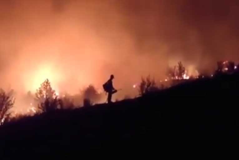
Firefighters in the Klondike West sector continue to implement an aggressive and adaptive approach to suppressing the fire in the Klondike West Zone. Additional hot shot crews, hand crews, and engines arrived yesterday. Three hotshot crews, 15 hand crews and 48 engines are now assigned to the Klondike West Fire. In addition, six heavy helicopters and four light helicopters are being utilized.
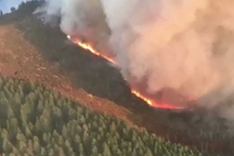
The retardant line along Silver Peak Ridge held through the day and the fire did not cross Silver Creek Ridge. Air tankers and large helicopters were used to keep the fire in check.
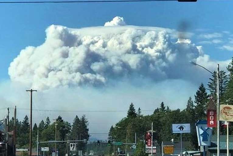
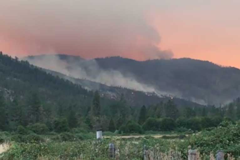
The fire also burned westward in the Silver Creek drainage where it became very active yesterday afternoon. The fire spread into to the confluence of Silver Creek and the Illinois River. A large smoke plume developed yesterday afternoon as the fire burned through dead and down trees killed in the 2002 Biscuit Fire. Northeast winds blew smoke in the direction of Gold Beach and Brookings.
Last night a strong east wind blew across the fire. Infrared images from a 10 p.m. Monday evening reconnaissance flight showed that approximately 1,000 acres of fire spread west of the Illinois River. Efforts are directed at limiting fire growth by using the 2015 Collier Fire burn scar.
Spots fires started west of the Illinois River yesterday which were aggressively attacked by air tankers and helicopters, however, several spot fires did burn together.
Planning for several possibilities is currently underway, including the last resort option of using fire-lines created during the 2002 Biscuit Fire situated north and west of the Illinois River as crews continue to construct additional fire-lines to help contain the fire in other areas as opportunities arise.
Taylor Creek and Klondike East:
Strong east winds overnight tested containment lines on the Taylor Creek and East Zone of the Klondike Fires. Gusts exceeding 30 miles per hour were recorded at the Onion Mountain Lookout weather station. The lines passed the test and held the fires within containment lines. On Tuesday crews will continue to repair fire suppression impacts, mop-up remaining hot-spots and actively patrol the fire-lines. Fire managers will continue right-sizing the organization, determining which resources are needed for the remaining work and which can be freed up to assist with other incidents.
Josephine County Sheriff Dave Daniel issued a downgrade of the fire evacuation levels on the Illinois River Road within the East Zone of the Klondike Fire. The downgrading shifts the area from milepost 2.5 to Oak Flat along the Illinois River Road to Level 1 “Be Ready”. This move represents the reduced risk to landowners from the fire in this area.
Wind gusts will begin to diminish in the late morning on Tuesday. Today will be warmer and drier with temperatures in the 80s and relative humidity dropping below 20%. These conditions could produce moderate fire activity in unburned islands of fuel within the fire perimeter, resulting in increased smoke. Forecasts call for a slight cooling trend beginning in the middle of the week.
Please Like, Share and Follow the …
![]()