

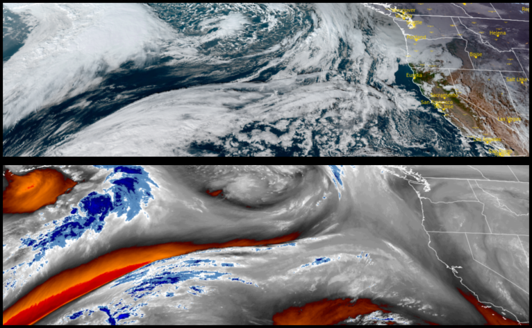
A cold front is forecast to move into the area beginning Thursday, ushering in more cold air, precipitation and snowfall. A wet weather pattern is expected as atmospheric river of activity combined with cold fronts could bring heavy rain snow to higher elevations through the weekend.
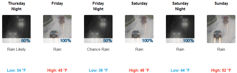
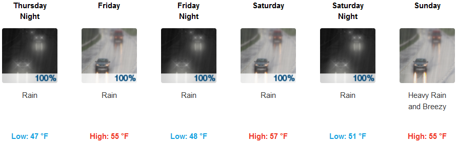
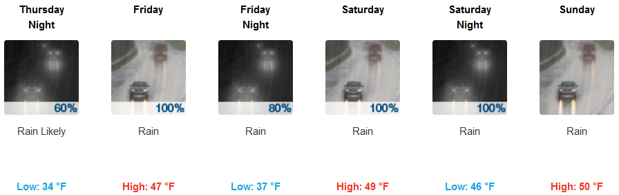
Inland rain is expected Thursday morning continuing through out the weekend with snow elevations starting at 4000′ Thursday, fluctuating between 3300′ and 4500′ as the weekend progresses. Low temperatures will be in the low 30’s with highs in the upper 40’s to low 50’s.
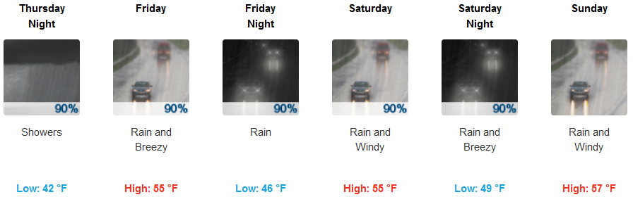
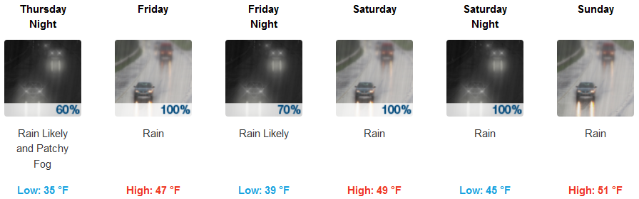
Coastal areas will see precipitation starting early Thursday morning and steadily continuing through the weekend. Afternoon high temperatures will stay in the low to mid 50’s with early morning lows in the mid 40’s
Brookings:

Crescent City:
Gold Beach:
Cave Junction:
Grants Pass:
Medford: