


Changes from summer to autumn weather patterns will be in full view this weekend. Expect rain showers beginning Friday night through Saturday as a strong front moves through the area.
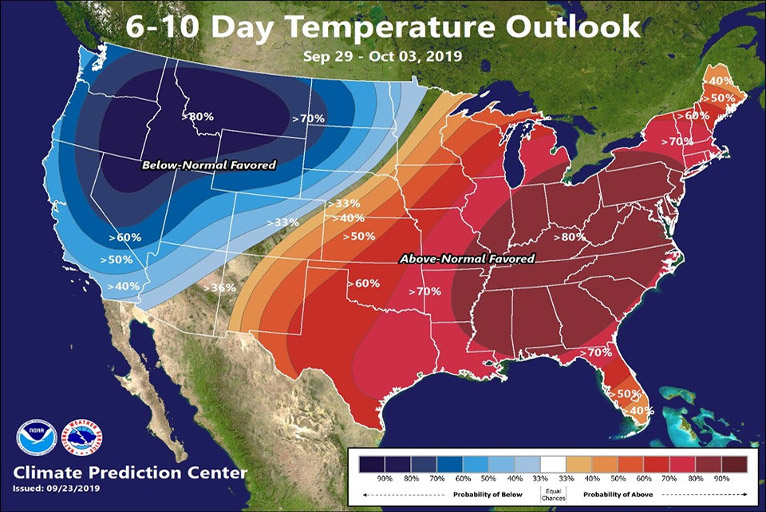
Temperatures had been above normal through Thursday, but cooler temperatures are coming. A cold upper-level storm system is forecast to drop south across the western United States Friday through early next week. Much cooler weather will develop across the region as a result, with the possibility of freezing temperatures overnight across wind-sheltered valleys.
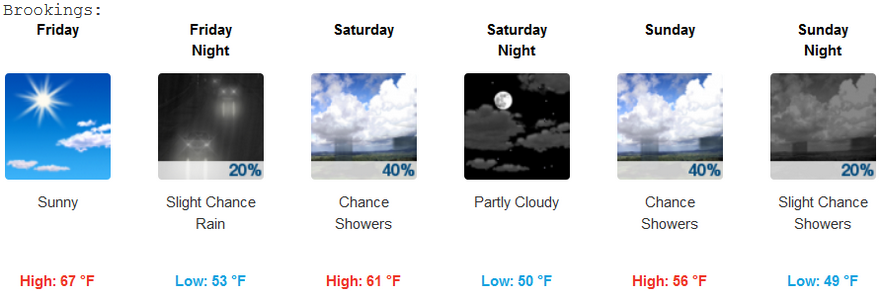
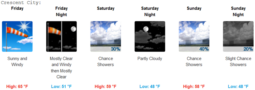

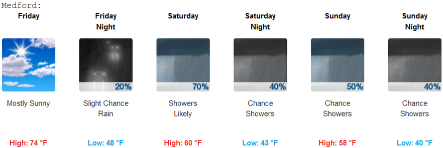
Isolated thunderstorm activity may be associated with the frontal passage on Saturday and should be accounted for in your outdoor plans. Light snow is also expected fall for areas above 4,000-5,000 ft., but should not pose a roadway hazard with snow only likely to stick to vegetation.
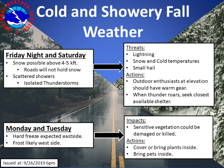
After the front moves through, temperatures will drop below freezing for places east of the Cascades and elevated peaks. Westside valleys will also be quite cold, but should not drop to freezing temperatures. Westside valleys like the Applegate, Shasta, and Rouge Valleys could observe some frost development overnight Monday and Tuesday.