

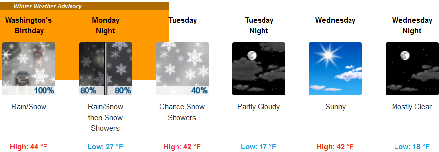
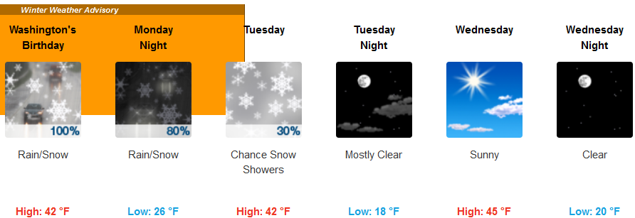
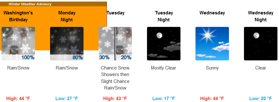
The work week will start off with a significant change in the weather pattern, as a cold front moves into the forecast area Sunday, bringing showers very early Monday morning with possible periods of snow.
Snow levels are expected to lower affecting a broader area as the week progresses. The warm temperatures of the past month are forecast to be replaced with below normal temperatures by mid-week with sub-zero temperatures possible east of Medford.
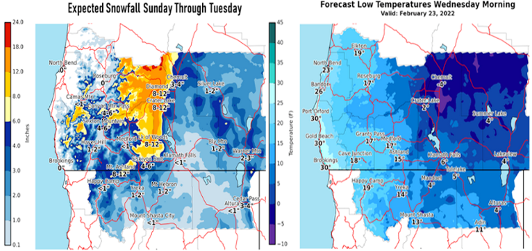
Inland, rain and snow showers are forecast to begin very early Monday morning with rain, possibly mixed with snow showers by late morning and the possibility of thunder as the cold front pushes warmer air out of the area. Precipitation is expected to decrease as the week progresses, however temperatures are expected to drop to the upper teens inland by mid-week, with highs only reaching the low 40’s.
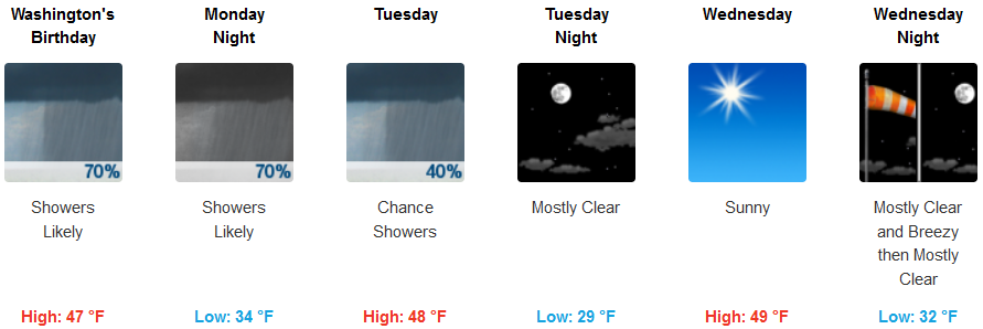
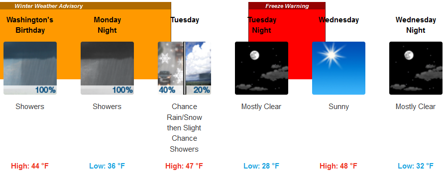
Along the coast, showers are forecast to begin very early Monday morning as the cold front pushes south and west into the southern Oregon and northern California area. As the cold air mixes with the warmer air moving east, thunderstorms are forecast as the unstable air moves into the area Monday, with the chance of showers dissipating Tuesday and temperatures getting to the mid 40’s for highs, and as low as the low 30’s by mid-week.
Brookings:

Crescent City:
Gold Beach:
Cave Junction:
Grants Pass:
Medford: