

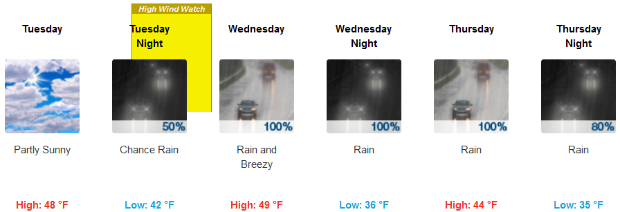
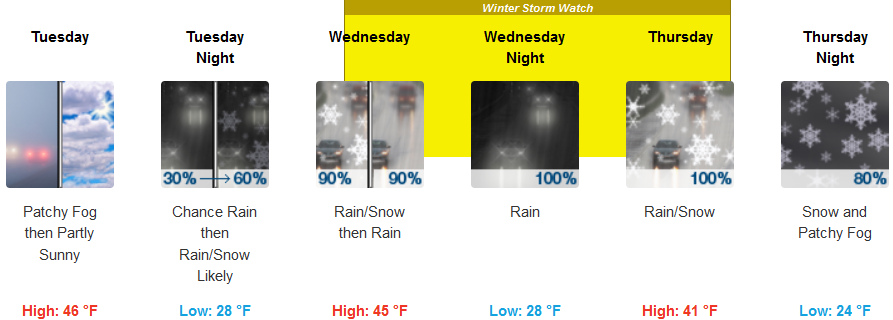
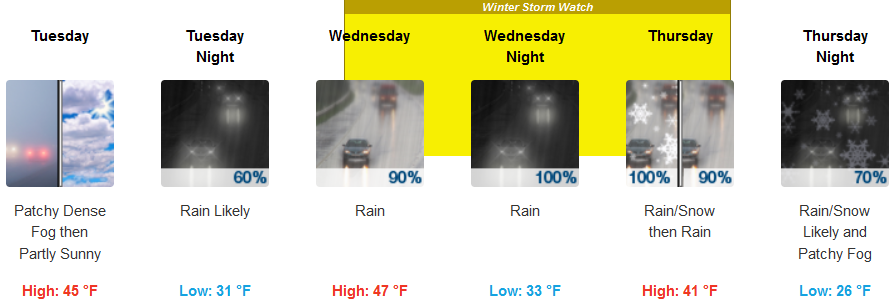
As the work week progresses, a ridge of cold air is forecast to move into northwest California and the Pacific Northwest with very cold air preceding precipitation expected later in the week. The National Weather Service has issued Freeze Warnings beginning early Monday morning along the northern California coast, with High Wind Watches and Winter Storm Warnings over much of the region.
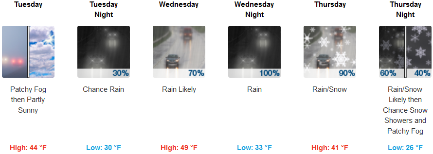
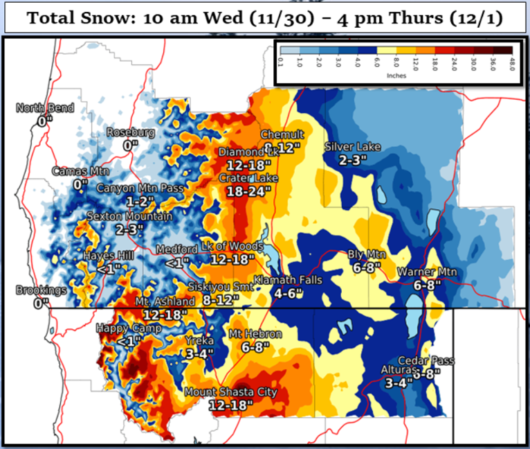
Heavy rainfall and the potential for low elevation snow are expected to impact the region Wednesday into Thursday. Moderate to heavy snow is anticipated above 2500 ft with light snow possible down to 1500 ft early Thursday morning. The heaviest snow is expected Wednesday evening through Thursday morning.
Inland areas should expect very cold temperatures, as low as the upper 20’s, starting late Monday evening under mostly cloudy skies with a mix of rain and snow expected to begin very late Tuesday evening or very early Wednesday morning. Early morning low temperatures could get as low as the mid 20’s in some areas with Moderate to heavy rain and snow is a above 2500 ft with light snow possible down to 1500 ft early Thursday morning.
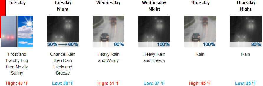
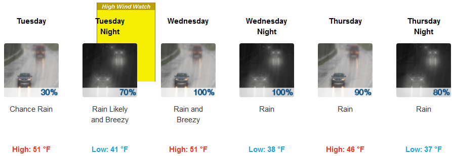
Coastal areas are expected to see temperatures drop quickly Monday evening, prompting Freeze Warnings along coastal areas of northern California as a new cold weather system moves into the region. Rain is expected Tuesday evening, continuing through Thursday. Temperatures along the coast are expected to be slightly warmer than inland, with lows in the low to mid 30’s and highs in the mid to upper 40’s.
Brookings:
Crescent City:
Gold Beach:
Cave Junction:
Grants Pass:
Medford: