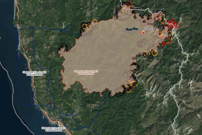
On Tuesday evening August 29th, 2017, authorities updated the Chetco Bar Fire situation. As of approximately 8:30 PM, the Chetco Bar Fire had blackened over 125,271 acres, adding more than 7,600 acres on Tuesday, and is reportedly 5% contained.
Evacuation levels changed from Level 3 to Level 2 on Tuesday, starting at the western checkpoint on North Bank Chetco Road at Da-Tone Rock and east to the North Fork of the Chetco River.
Tuesday’s most active area was again to the east near Johnson Butte which put a column up to 16,000 feet. It then advanced 3.5 miles to the Northeast into the Biscuit scar. The eastern flank of the fire is expected to burn east, out of Kalmiopsis Wilderness and toward private lands. Tuesday’s advances extended into some re-burn areas and several areas active on the north and southern exposures with wind driven runs, torching, and crowning.
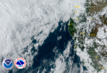
As a weak and dry cold front approaches the Oregon coast, officials report that the upper-level ridge responsible for the recent hot and very dry weather is in the process of breaking down. This system is expected to deepen the marine layer over night, with low clouds and/or fog likely to become widespread for all but the highest elevations of the fire. Good humidity recoveries are expected tonight. Moisture associated with the deep marine layer is expected to linger into Wednesday, then increasing North to Northeast winds will dry out the region Wednesday night through Friday.
Tuesday evening fire officials expect low to moderate fire behaviors consisting of creeping, smoldering and some surface spread in higher elevations. Wednesday afternoon should see a more active fire behavior with surface spread and possibly some isolated torching. Later into the week, officials are preparing for a critical burn environment with a high potential for extreme fire behavior with more torching, spotting, flanking, possible crown runs and plume development depending on the accuracy of weather predictions.
The approximately 1470 personnel fighting the widespread fire area continue building and reinforcing direct and indirect containment lines with direct dozer lines and hand lines. Firefighters will continue structure protection efforts, hose laying, removal of flammable materials and road improvements for fire lines.
Displaced residents may relocate to an emergency evacuation shelter at Riley Creek Elementary in Gold Beach 94350 6th St. Gold Beach, OR. (541)-600-6068. Travelers in campers and motels are asked to relocate elsewhere along the Oregon coast. Residents should make arrangements to move property and livestock. People with special health needs or other concerns should relocate during the warning.


