

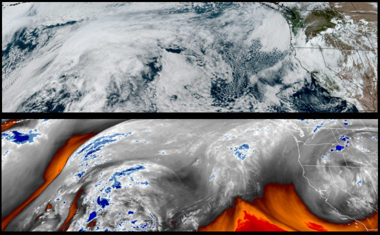
The upper level low that pushed weather systems into the area over the past week has shifted to the south and west leaving partly cloudy skies and mostly sunny warmer days to start the work week.
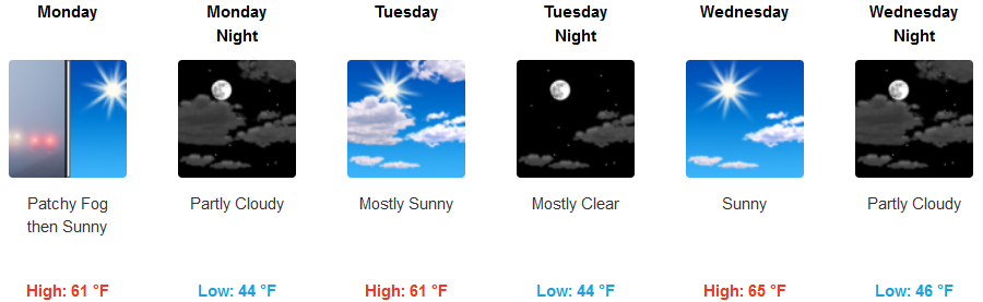
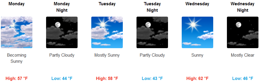
Areas inland are expected to see the remnants of the unstable air associated with the last weather system early Monday before partly cloudy skies begin to become mostly sunny skies establish by mid-week. Temperatures will slowly warm from the upper 50’s to upper 60’s going into mid-week.
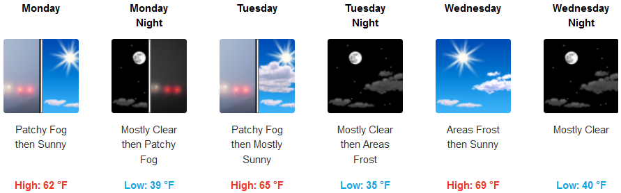
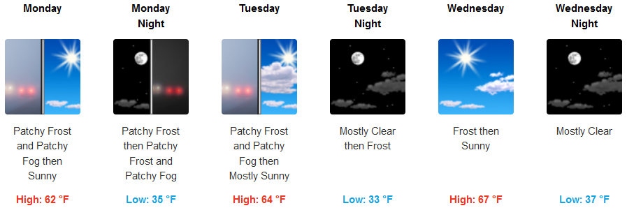
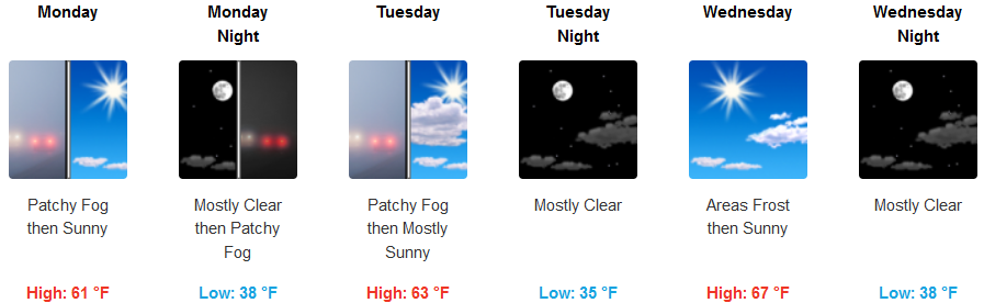
Coastal areas are forecast to see localized early morning fog under partly cloudy skies and marine layer cloudiness before afternoon clearing and mostly sunny skies become more prominent by mid-week. Morning lows are expected to be in the mid 40’s with afternoon highs possibly reaching the mid 60’s.
Brookings:
Crescent City:
Gold Beach:
Cave Junction:
Grants Pass:
Medford: