

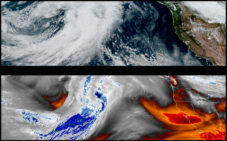
The low pressure system responsible for the thunder and lightning storms and unsettled weather primarily inland over the weekend, has moved off to the east and an upper level trough with an onshore flow will usher in mostly clear skies into and through the middle of the workweek.
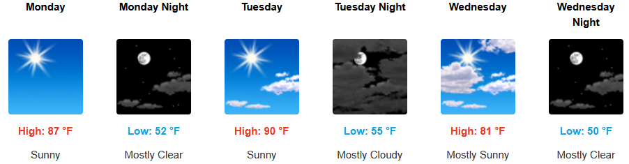
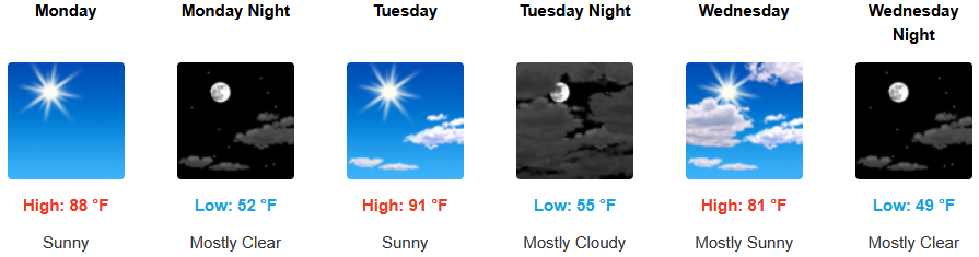
Inland areas are forecast to see clear skies and rising temperatures through midweek with a quick warmup to start of the week. Afternoon highs are likely to be 5-10 degrees above season norms. After a quick warmup the start of the week, afternoon highs are expected to reach the upper 80’s to low 90’s, with lows in the low to mid 50 ‘s.
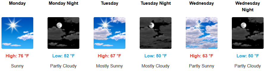
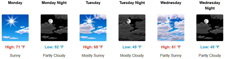
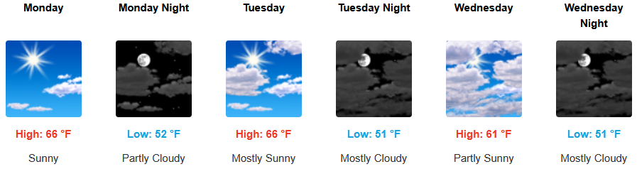
Along the coast, mostly clear skies and relatively warm temperatures continue into midweek with the usual probability of an early morning marine layer along the immediate coastline. Temperatures are expected to be mild in the low to mid 50 ‘s, and highs expected to reach the mid 70’s to start the workweek.

Brookings:
Crescent City:

Gold Beach:
Port Orford:
Cave Junction:

Grants Pass:
Medford: