

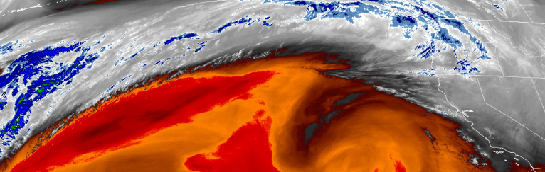
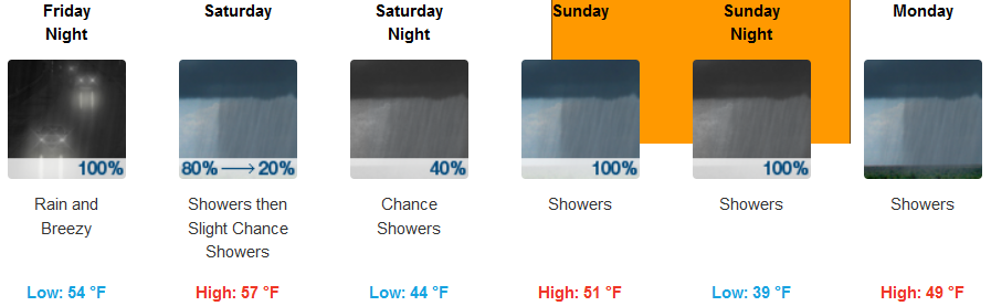
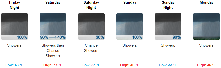
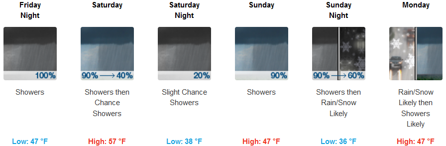
A cold front following the weather system from earlier in the week began moving into the region Thursday, bringing cold temperatures and rain to most of southern Oregon and northern California through the week end.
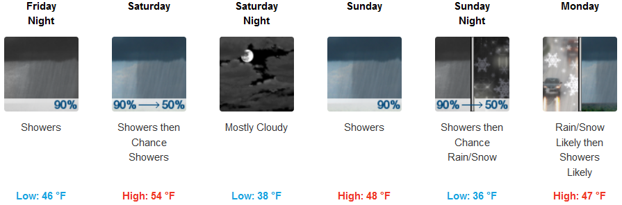
Snow levels are expected to drop significantly to as low as 2500 feet as the colder air mass moves in Saturday. Rain is expected to begin in the inland locations Friday night, with snow possible as low as Medford Sunday evening into Monday. An 11 to 14 mph southwest wind could gust as high as 21 mph with low temperatures as low as the low 30’s.
Coastal areas could see showers begin as early Friday morning, with a 16 to 20 mph wind that could gust up to 30 mph. Temperatures along the coast are expected to be warmer than inland passes with temperatures ranging between the mid 40’s to mid 50’s.
Brookings:
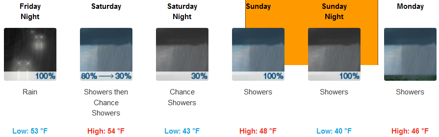
Crescent City:
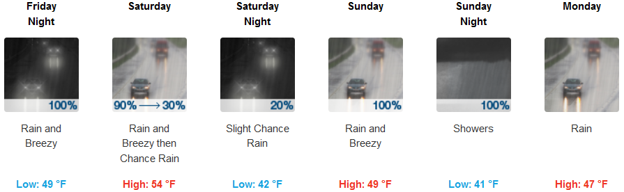
Gold Beach:
Cave Junction:
Grants Pass:
Medford: