

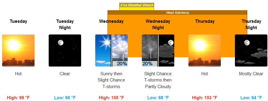
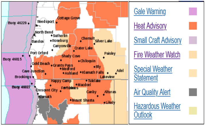
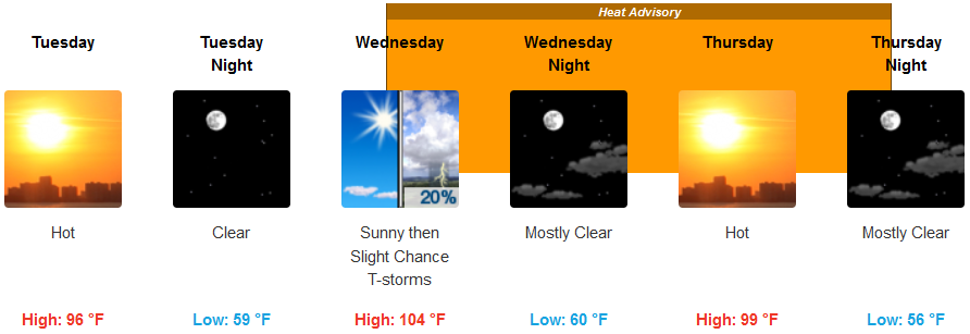
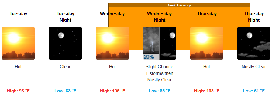
Heat Advisories have been issued by the National Weather Service as temperatures once again are forecast to steadily increase across most of southern Oregon and northern California as the week continues, possibly reaching and exceeding triple digits in some areas.
Inland valleys in southern Oregon and northern California counties will see hot temperatures will develop Tuesday and persist through Thursday. Monsoonal moisture will meet with a disturbance moving across southern Oregon and northern California producing another round of thunderstorm chances beginning Tuesday and continuing into Thursday. High temperatures will begin in the high 90’s and steadily increase as the work week progresses, possibly reaching 105 degrees by weeks end.
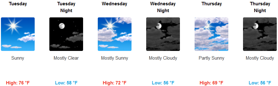
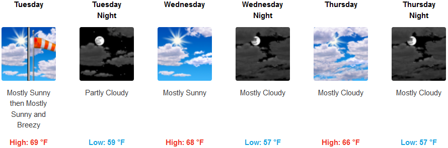
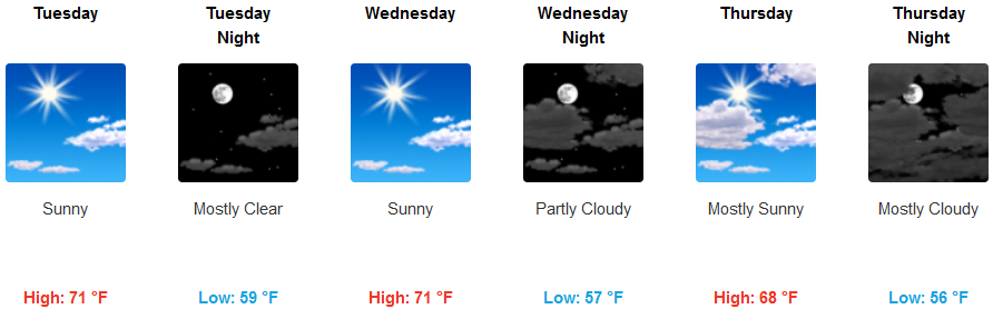
Along the coast, temperatures are expected to warm slightly compared to recent days under mostly clear skies with the possibility of a slight north to northwest wind possibly gusting to 20 mph in some areas. Thunderstorms are not expected to reach coastal areas, however, some clouds pushing up from the south are expected by weeks end. Temperatures will get as high as the mid 70’s in some coastal areas, cooling to the mid 60’s for highs by mid week.
Brookings:
Crescent City:
Gold Beach:
Cave Junction:
Grants Pass:
Medford: