

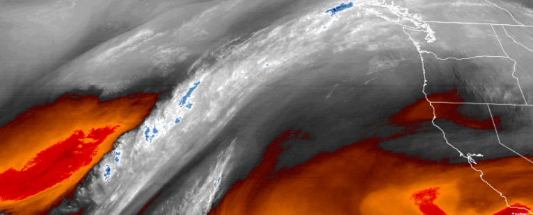
After consecutive days of cloudy skies and heavy rains, the low pressure system has moved to the east and with it, pushing the moisture to a pattern impacting Washington. However, precipitation from the unsettled weather moving into the area could result in localized showers.
As this system continues to move to the east, the weather pattern will bring moisture into the southern Oregon northern California regions starting Thursday, and continuing into the weekend.
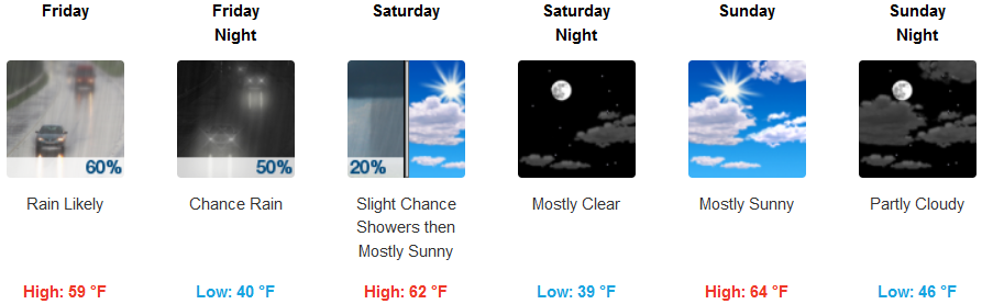
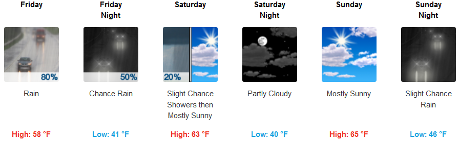
Inland, there is a good chance for precipitation beginning Friday and increasing as the day continues, before clearing to partly cloudy skies Saturday and early Sunday before a slight chance of showers Sunday night. Temperatures are forecast to remain relatively cool with high temperatures reaching the upper 50’s and low 60’s, and lows in the mid to upper 40’s.
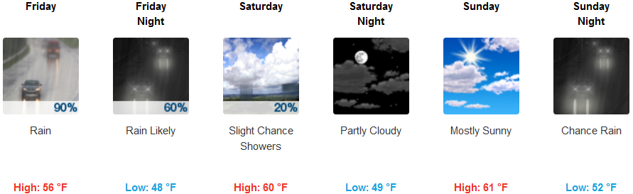
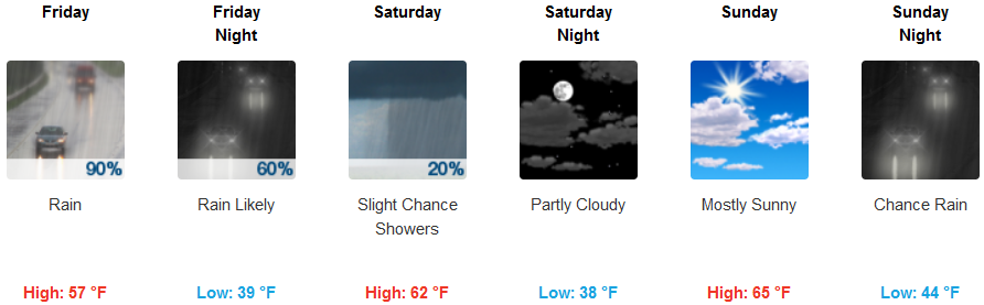
Coastal regions are forecast to see localized showers through Thursday, increasing as the day continues and into Friday. Saturday should see clearing to partly cloudy skies with localized showers possible, and an increase in precipitation chances Sunday evening. Temperatures are forecast to range from lows in the upper 40’s and highs in the mid 50’s.
Brookings:
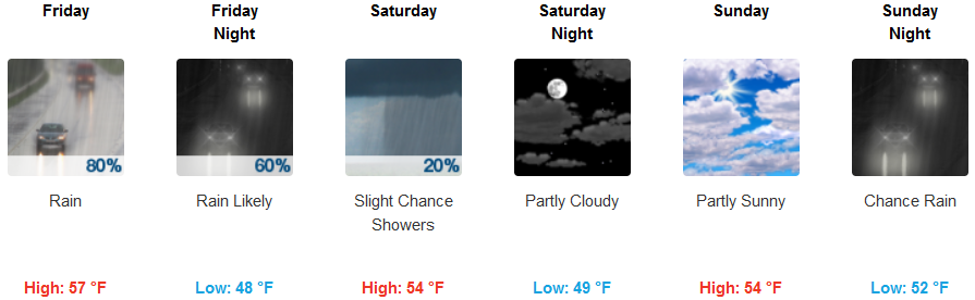
Crescent City:
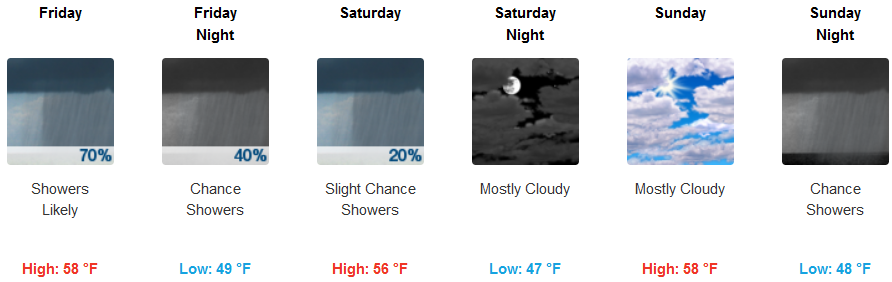
Gold Beach:
Cave Junction:
Grants Pass:
Medford: