

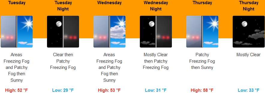
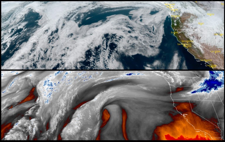
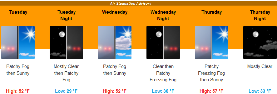
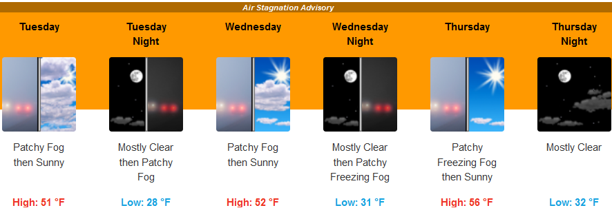
A relatively strong ridge of high pressure has established itself off the coast pushing weather systems to the north and pushing a very cold air mass across the region. As a result, the National Weather Service has issued an Air Stagnation Warning for much of the week over a large area of southwestern Oregon and northern California, including inland valleys.
Inland areas should expect early morning patchy localized fog, clearing to mostly clear skies with high clouds, early in the week, and slight winds if any. Temperatures are expected to continue to be very cold, with early morning lows getting down to the upper 20’s and afternoon highs only reaching the low 50’s.
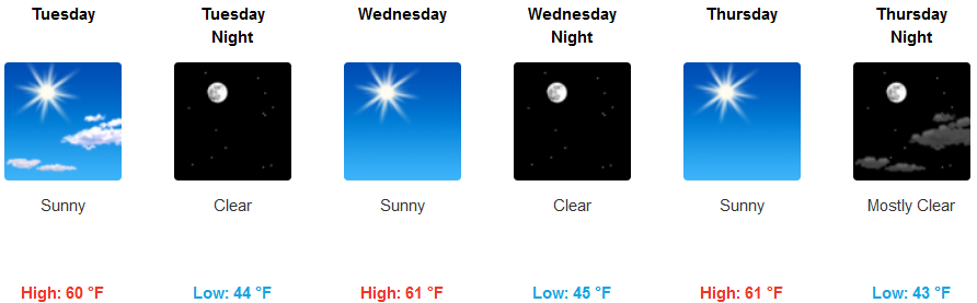
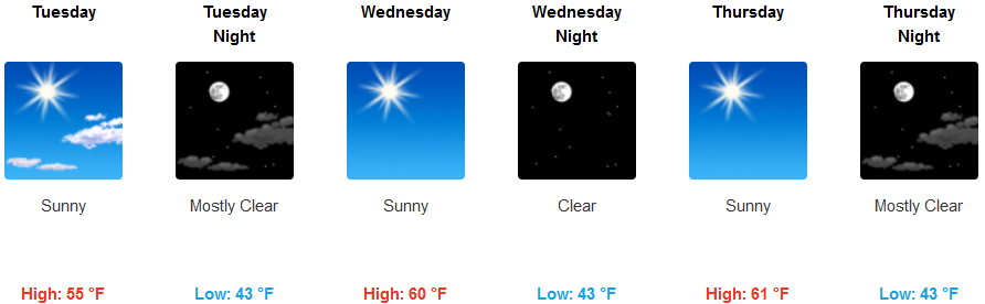
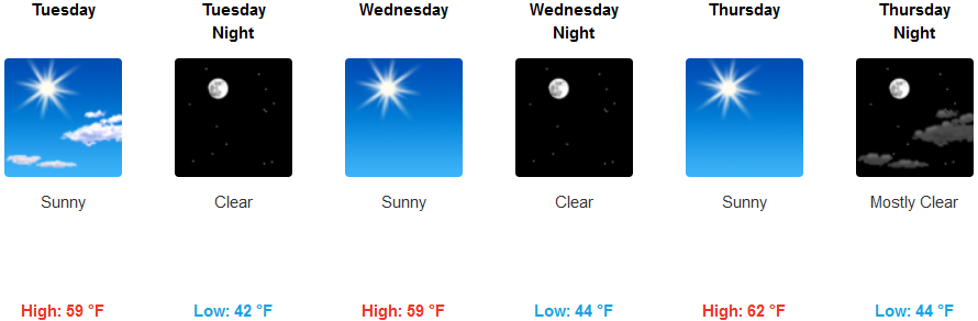
Areas along the immediate coast are forecast to also see mostly clear skies with high clouds early in the week. Temperatures in most areas are expected to be considerably warmer than our neighbors to the east with lows only getting to the low 40’s and highs reaching the low 60’s.
Brookings:
Crescent City:
Gold Beach:
Cave Junction:
Grants Pass:
Medford: