


A High Wind Watch has been issued for Humboldt, Del Norte, portions of Mendocino counties and are expected on southern Oregon coastal areas from Thursday morning through Friday afternoon. Max wind gusts over 50 mph possible on coastal headlands and over 60 mph on mountain ridge tops. Winds will be lighter elsewhere but still very gusty at times.
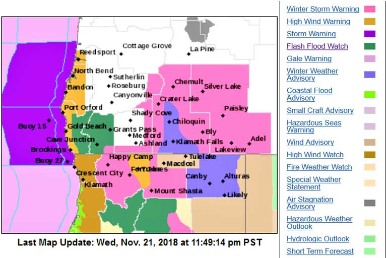
Coastal flooding is likely around Humboldt Bay, especially on Friday. The water levels of the month are expected Friday due to the perigean spring tide. Strong southerly winds will increase water levels above already high tides.
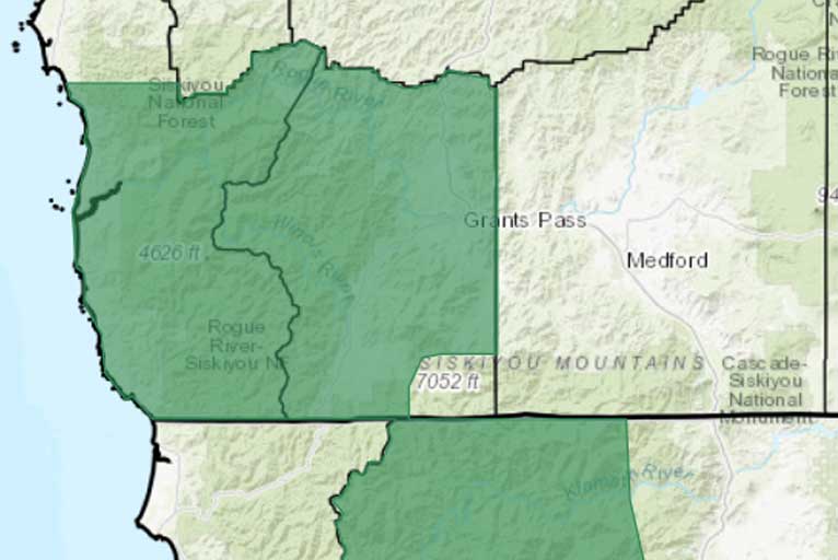
The first of three rounds of rain and wind began Wednesday morning. Coastal thunderstorms capable of gusty winds and small hail will be possible this afternoon into early Thursday morning. Debris flows are possible near the Carr, Delta, Chetco and Klondike burn scars and area rivers and creeks could see rapid rises.
Flash floods and debris flows warnings remain in effect and are possible due to heavy rain at times. Peak rainfall rates could reach up to one half of an inch per hour at times. The heaviest rain will occur late Thursday morning through Thursday afternoon. After a brief break Thursday evening, another period of heavy rainfall is possible late Thursday night into Friday.
Please Like, Share and Follow the …
![]()