


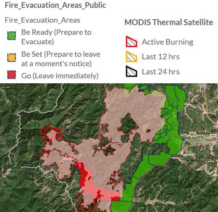
The Taylor Creek and Klondike Fires were split into zones on Saturday, Aug. 18. The fires are now referred to as “Taylor Creek and Klondike East Fires,” managed by the Alaska Incident Management Team out of Lake Selmac, and “Klondike West Fire” managed by California Interagency Incident Management Team 4 out of Gold Beach. CIIMT4 was called in to continue with the aggressive fight to fully suppress the fire. This will allow the Alaska Incident Management Team to focus its effort on controlling the southeast corner of the fire that is directly threatening the communities of Selma and Cave Junction.
As of the morning of Aug. 19, the Taylor Creek Fire is estimated 52,588 acres and is 61 percent contained. The Klondike Fire is estimated at 68,241 acres and is 15 percent contained. There are 579 personnel working on the Taylor Creek Fire and 845 personnel assigned to the Klondike Fire.
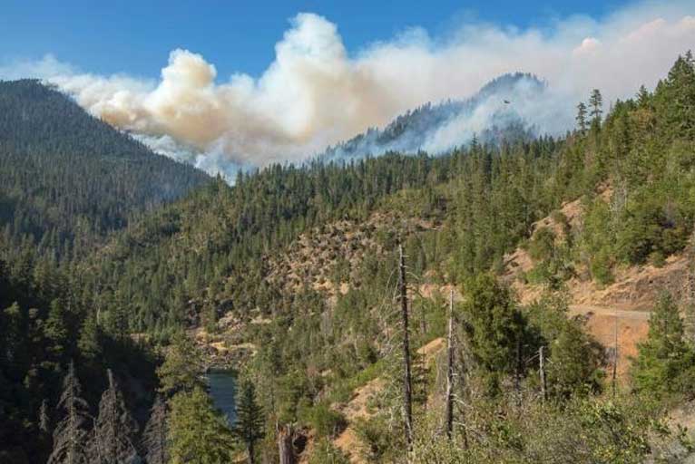
Extremely dry fuels and hot, dry weather have fueled the continued growth of both fires. Steep, rugged, inaccessible terrain combined with limited resources due to intense wildfire activity across the western United States has made suppression efforts a challenge. In addition, smoky conditions have limited the use of aircraft to suppress and monitor both fires.
Both fires have spread into and are actively burning in the scar of the 2002 Biscuit Fire, which has contributed to the western spread of the fires. The western edge of the Klondike Fire has now spread into the Kalmiopsis Wilderness and is just miles from Agness and bumping up against the burn scar from the 2017 Chetco Bar Fire, which fire managers are using as a natural containment line.
In the Taylor Creek and Klondike East areas, although extreme temperatures and low relative humidities prevailed on Saturday, forecasted wind gusts did not materialize during the day, resulting in continued burning but not extreme fire activity. Smoke remained and reduced fire activity predominated in much of the area. The most active part of the Klondike East Fire remains the southeast corner near Selma. Firefighters were able to conduct burning operations that strengthened the control line along Babyfoot Road by connecting it with another control line to the east. Helicopters made water drops on advancing lines on the southeast portion of the fire and drones were used to ignite fire on ridges between advancing fire in valleys.

On the south corner of the fire, firefighters on the night shift used a drone to initiate aerial firing operations in the Fall Creek drainage around Pocket Knoll and Forest Road 090 to keep pace with fire already established on the ridge. The objective is to create a buffer wide enough to prevent the fire from gaining momentum as it approaches Babyfoot Road, which firefighters are using as a control line. Fire activity along Illinois River Road was quiet and unlike the previous night, fire behavior mellowed at around midnight and remained relatively calm through the rest of the night.
In the Taylor Creek and Klondike West areas, California Interagency Incident Management Team 4, a Type-1 team, is managing the west side of the Taylor Creek and Klondike Fires, referred to as Klondike West. Crews continue to mop up the western edge of the Taylor Creek Fire along Chrome Ridge. This part of the fireline is looking more secure each day. From there, crews are working to open the overgrown Flat Top Road to Chinaman Hat Road. The plan is to make this road a primary fireline. A problem area exists, however, in a bulge in the open fireline that extends from Chinaman Hat to Bald Mountain. Yesterday, clear air allowed helicopters to slow the fire burning in the bulge. Helicopters will continue to work in this area again today if the air is clear. The goal is to eventually allow crews to work next to the fire’s edge and drive it into the area previously burned during the Chetco Bar Fire.
A variety of primary, alternate and contingency lines are also being planned. A structure group supervisor will be placed in the Oak Flat Area and Agness areas as part of contingency pre-planning.
A Community meeting is scheduled for Monday (today), August 20, 6:00 pm in Cave Junction at Illinois Valley High School, 625 E River St., Cave Junction. Fire personnel from both the Alaska Incident Management Team and California Interagency Incident Management Team 4 will be present to provide an overview of the two fires and answer questions.
Smoke, however, is forecast to return Monday, even to some areas that haven’t seen much smoke yet such as the Roseburg and Coos Bay areas.
(This smoke model clearly shows the break Sunday evening across the Rogue Valley.)
The fire activity forecast has been downgraded from “Critical” to “Elevated,” which will continue through Tuesday. Weather is expected to be moderate later in the week with cooler temperatures, higher relative humidities and lower wind speeds. Fire perimeters are expected to expand.
A variety of primary, alternate and contingency lines are also being planned. A structure group supervisor will be placed in the Oak Flat Area and Agness areas as part of contingency pre-planning.
Public meetings are scheduled on Monday, August 20, 6 p.m. in Agness at the Agness Community Library, 3905 Cougar Lane, Agness, and again on Tuesday, August 21, 6 p.m. at the newly located California Interagency Incident Management Team 4 command center in Gold Beach at the Curry County Fairgrounds in the Curry Showcase Building, 29392 Ellensburg Avenue.
Please Like, Share and Follow the …
![]()