

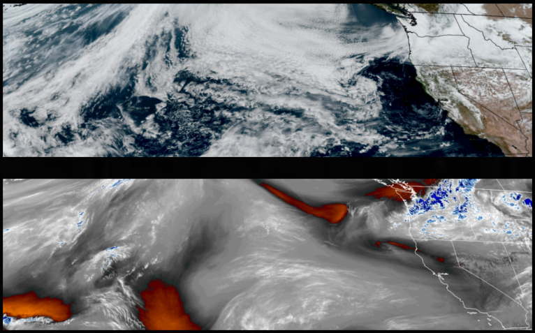
The trough of low pressure responsible for the round of precipitation to start the work week is expected to have moved to the east after midweek, leaving a ridge of high pressure behind it with mostly sunny skies and warmer temperatures going into the weekend, before chances of rain return over the weekend.
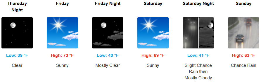
Slight chances of rain remain for inland areas into Thursday morning before mostly clear skies and warmer temperatures move over the area going into the weekend before chances of rain return Sunday. Temperatures are expected to remain relatively mild with afternoon highs ranging from the upper 60’s to low 70’s, with lows forecast to be in the low 40’s.
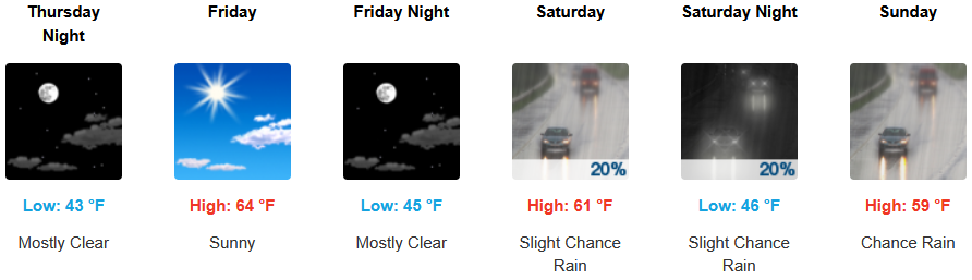
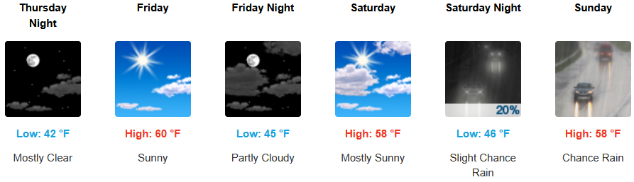
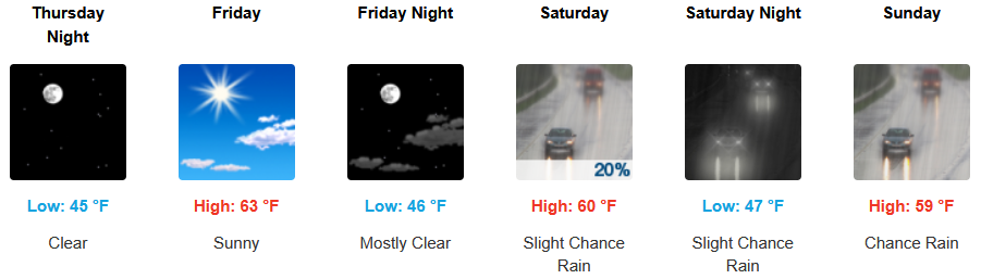
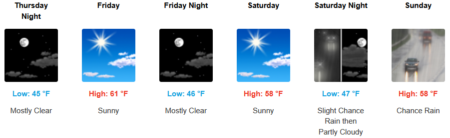
Coastal areas are forecast to see mostly clear skies to start the workweek with mild temperatures through the weekend before another chance of rain approaches the coast as early as Saturday. Highs are expected to be in the low to mid 60’s, with lows forecast to be in the low to mid 40’s.

Brookings:
Crescent City:
Gold Beach:
Port Orford:
Cave Junction:
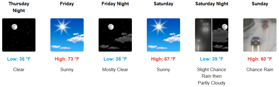
Grants Pass:
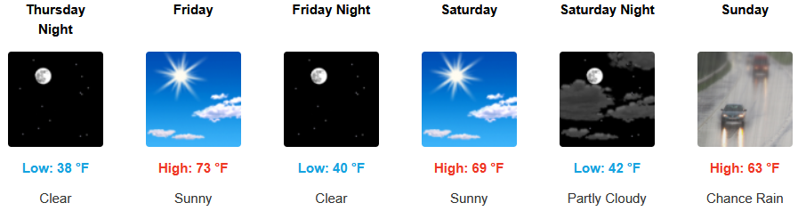
Medford: