

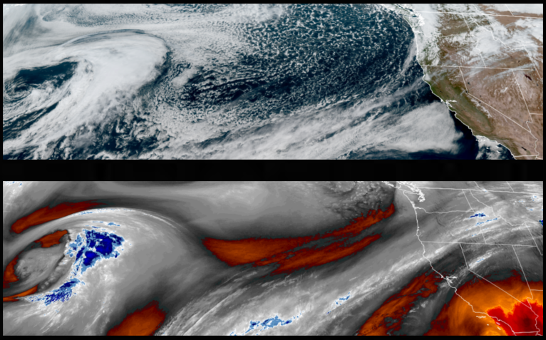
Clearing skies behind behind a dry cold front will bring cold temperatures close to or below freezing in the valleys before another round of cooler air and significant rain moves into the area as soon as Sunday.
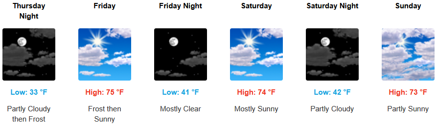
Inland areas can expect near freezing morning cold temperatures under partly cloudy skies moving into the weekend and continuing into Sunday before cooler air and significant rain moves into the area as soon as Sunday. Afternoon highs will start the week in the mid to upper 60’s, with lows forecast to be in the low 30’s.
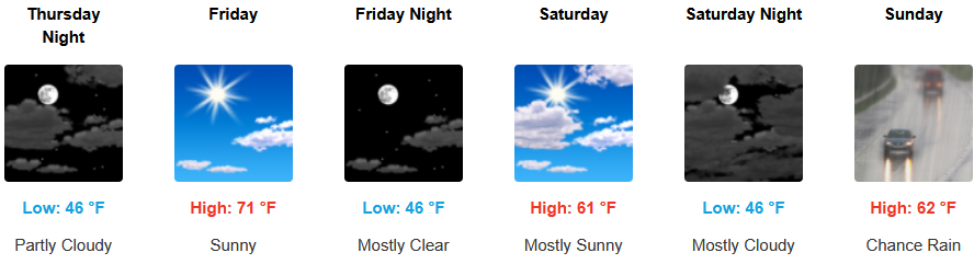
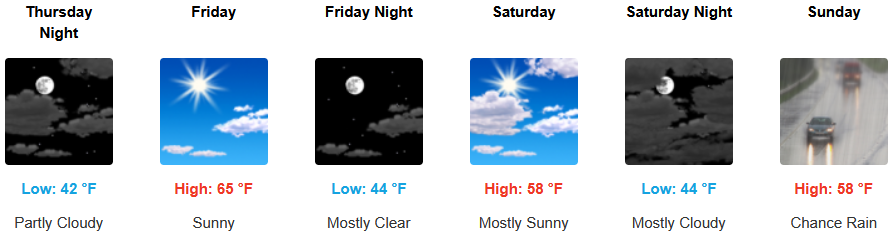
Along the coast, partly cloudy skies cool mornings and mild afternoon temperatures continue into the weekend before chances of rain move into the region Sunday. Highs are expected to be in the mid to upper 60’s, with lows forecast to be in the low to mid 40’s.

Brookings:
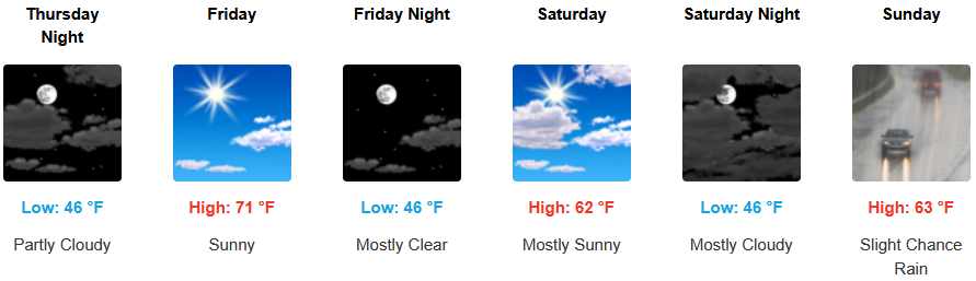
Crescent City:
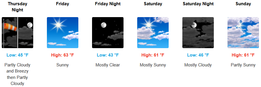
Gold Beach:
Port Orford:
Cave Junction:
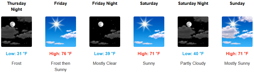
Grants Pass:
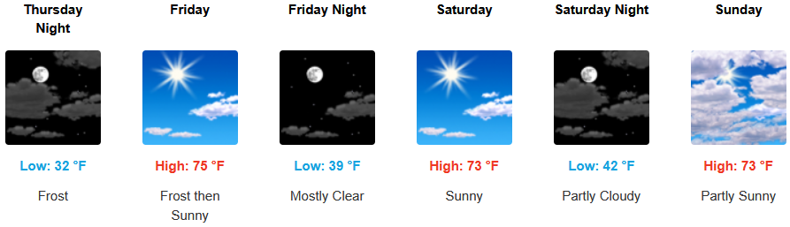
Medford: