

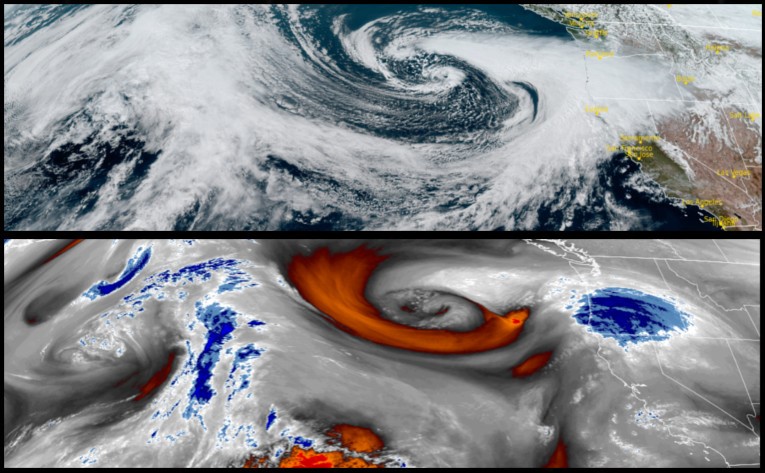
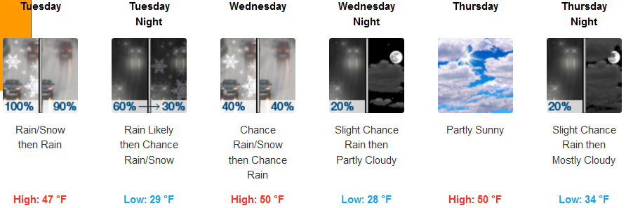
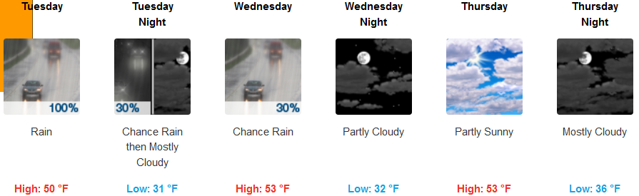
A strong area of low pressure is moving on shore bringing heavy rain and high winds through Tuesday with the heaviest rainfall expected Tuesday along coastal Central California with the outer edges of the system reaching southern Oregon.
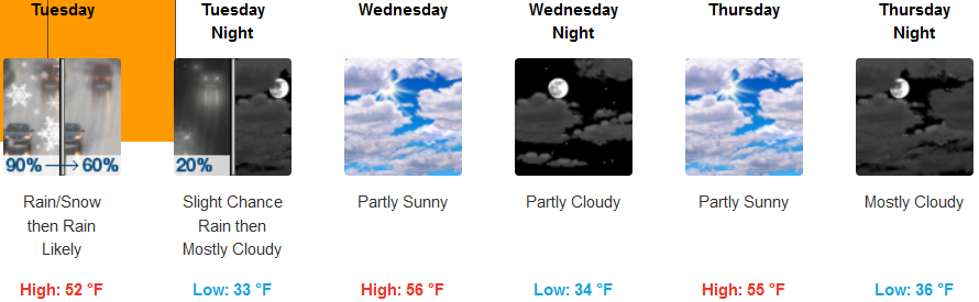
Inland areas can expect rain and snow, becoming all rain after noon with snow levels starting at 1800ft. in the morning and rising to over 3000ft. by late afternoon. Wind Advisories from the National Weather Service remain in effect through Tuesday with wind gusts over 25mph are possible. Skies will become partly sunny mid-week with localized showers possible as unstable air moves to the east. Early morning lows will be in the low to mid 30’s with highs possibly reaching the upper 50’s.
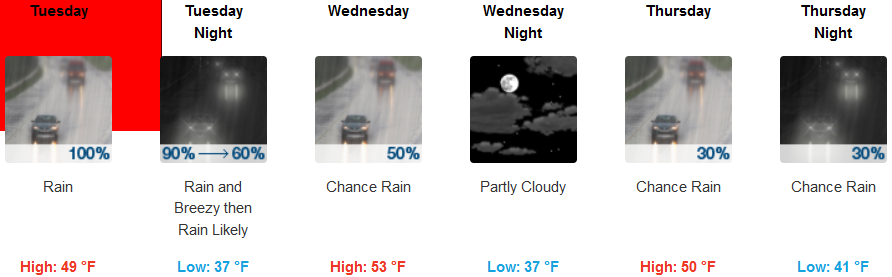
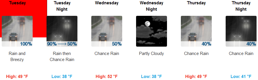
Coastal areas remain under a High Wind Warning issued by the National Weather Service through Tuesday with rain forecast into Wednesday before a brief break in the wet weather as chances for precipitation diminish as the work week progresses. Wind gusts as high as 30mph are possible Tuesday with temperatures remaining relatively warm with lows in the upper 30’s to low 40’s and highs in the mid 50’s.
Brookings:
Crescent City:
Gold Beach:
Cave Junction:
Grants Pass:
Medford: