

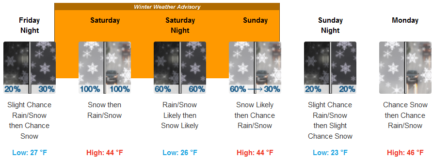
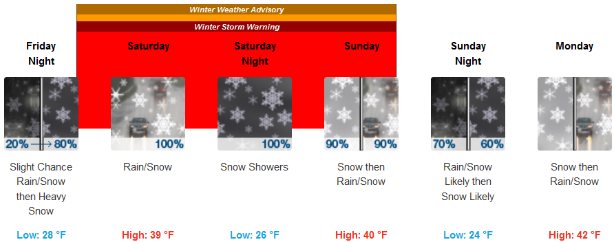
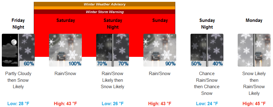
Another winter storm system is forecast to move into the region beginning Friday, bring with it cold temperatures again that are expected to bring ice and snow to passes and dropping snow levels to 500ft. and possibly to the valley floor in some locations.
Inland areas are expected to see snow accumulations as early as late Friday evening and early Saturday morning and a mixture of rain and snow is expected through Monday. Moderate to heavy snow is anticipated above 1500 ft. The heaviest snow is expected Saturday morning and again Saturday night. High temperatures are expected to get to the mid 40’s, with early morning lows falling into the mid 20’s over the weekend.
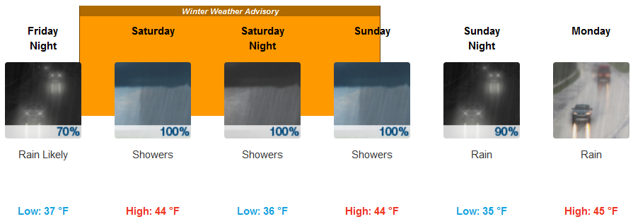
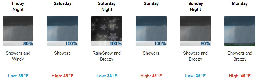
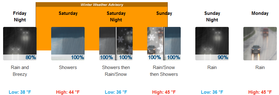
Coastal areas will remain under a National Weather Service Winter Weather Advisory through the weekend. Rain and thunderstorms are forecast through the weekend with a steady wind gusting to 30mph. Snow levels will be between 1200 to 1500ft with snow expected on most passes throughout the weekend. Highs will get into the low to mid 40’s, while early morning lows drop to the mid 30’s.
Brookings:
Crescent City:
Gold Beach:
Cave Junction:
Grants Pass:
Medford: