

A cold front is forecast to bring some light rain to portions of the area on Saturday, however, temperatures are not expected to be as cold. This cold front will bring a significant chance for rain across much of southern Oregon, and northern California, followed by moderate winds and another weather system late Sunday evening into Monday morning.
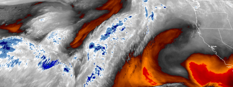
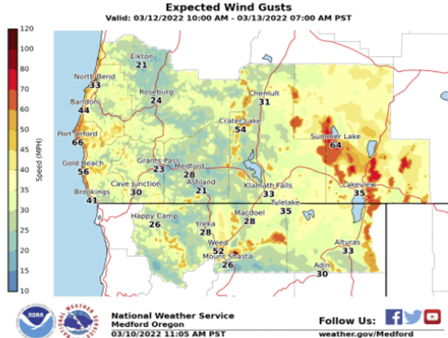
A High Wind Watch has been issued as moderate to strong winds are expected to occur across portions of southern Oregon and northern California Saturday afternoon and into Sunday morning. These winds will become strong along the coast, especially at and south of Cape Blanco.
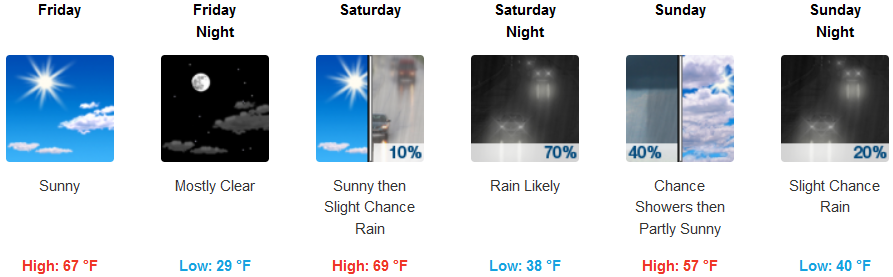
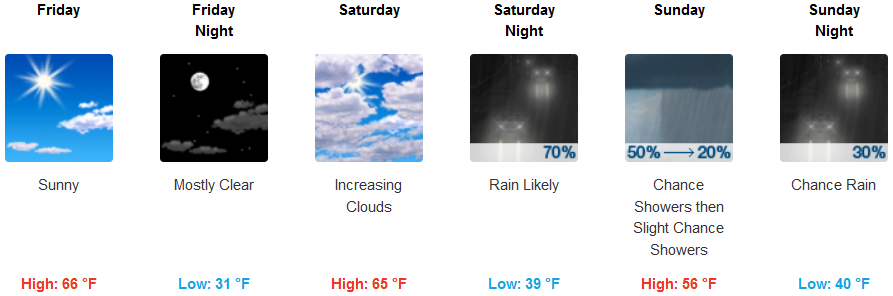
Inland areas are forecast to see mostly clear skies on Friday, with increasing clouds Saturday and rain likely Saturday night. Snow levels will be very high Friday, above 5000 ft., lowering Saturday to 3500 ft. with a steady 10-15 mph wind gusting to 20 mph Saturday night. Low temperatures are expected to be in the upper 30’s to low 40’s, with highs getting to the mid 60’s.
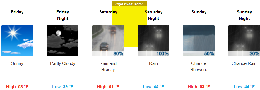
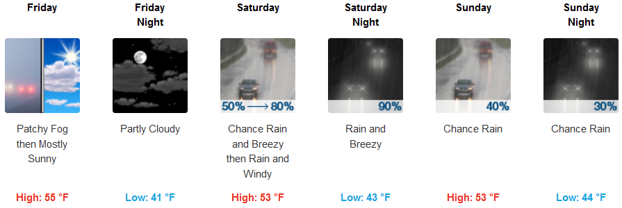
Coastal areas will be clear with afternoon temperatures in the upper 50’s to low 60’s Friday, before a cold front moves in late Friday evening bringing some light rain to portions of the area on Saturday. A Frost Advisory has been issued for coastal areas above Port Orford, and below Crescent City, California to the south, Saturday morning. Early morning lows are expected to be in the mid 40’s, with highs in the mid 50’s.
Brookings:
Crescent City:
Gold Beach:

Cave Junction:
Grants Pass:
Medford: