

A new cold front is forecast to move into southern Oregon and northern California beginning late Thursday ushering in a new round of cold air and moderate to heavy precipitation with snow levels starting at around 4000 feet across the passes before lowering to 1000 feet early Friday morning. Rain and snow showers are expected to continue through Saturday before clearing on Sunday.
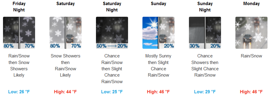
Away from the coast, Winter Weather Advisories and Warnings have been issued by the National Weather Service for much of southwestern Oregon and northern California as a mix of rain and snow showers are expected throughout the weekend and snow levels changing as the front moves over the region. Afternoon highs are expected to reach the upper 40’s with early morning lows hovering in the low 30’s, however, falling to the mid 20’s at higher elevations.
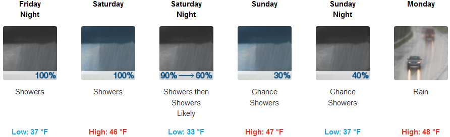
Coastal areas are forecast to see rain, heavy at times for much of the weekend, before a slight break Sunday as the system moves to the east and another poises itself off-shore. Temperatures again will be relatively mild compared to just a few miles inland with afternoon highs in the upper 40’s, and lows getting into the mid 30’s.
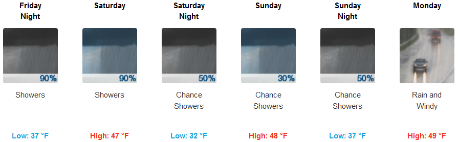
Brookings:
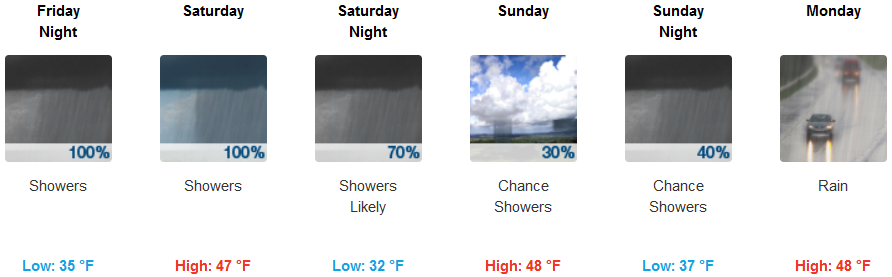
Crescent City:
Gold Beach:
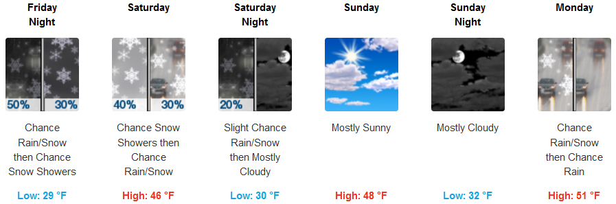
Cave Junction:
Grants Pass:
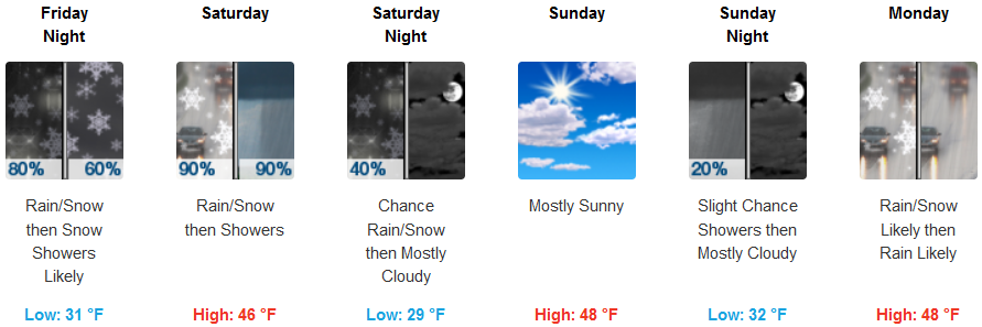
Medford: