


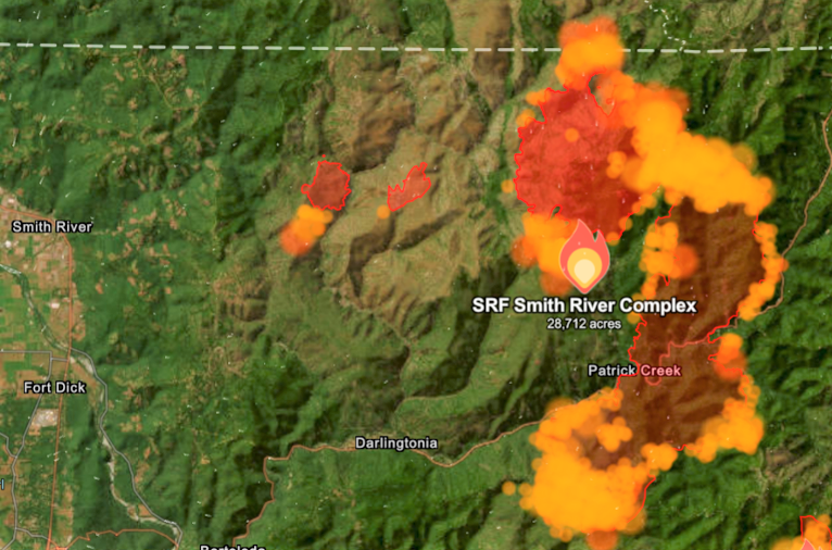
Sunday afternoon reports from fire authorities regarding the Smith River Fire Complex, the Sunday morning report stated that total acreage sat a 22,351 acres of brush and timber had been consumed, and by Sunday evenings report, the fire had expanded another 6,361 acres, growing to more than 28,712 total acres with 0% containment.
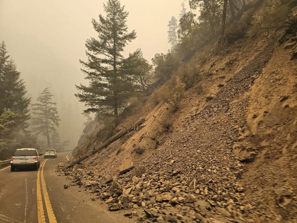
At 2:00pm remained U.S. Hwy. 199 remained closed and it was reported that the Oregon State Police planned to close the road at the ‘Welcome to Oregon’ sign and requested the Agriculture Station near the Oregon border on U.S. Hwy. 199 to evacuate. Del Norte County remained with out power as the Office of Emergency Services told customers to plan for a multi-day power outage situation as fire growth was affecting power transmission.
Gasquet residents reported getting ‘Level 3, Go !’ evacuation orders at approximately 2:30pm Sunday afternoon due to a combination of extreme fire and weather behavior, with the area being closed off after 8:00pm. However, the forward operating base at the Gasquet airport will remain operational with essential firefighting personnel protecting the town of Gasquet.
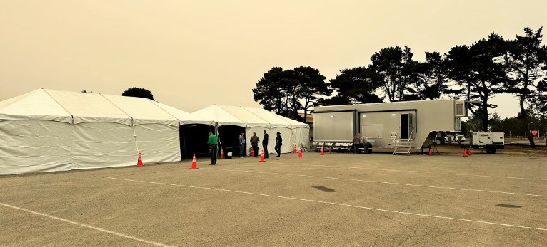
In coordination with Pacific Power, 2 Community Resource Tents have been made available at the Del Norte High School Parking lot including charging stations where phones, tablets, and battery back ups can be charged. These tents also include a hose system installed by the City of Crescent City to fill buckets of water.
Crews also worked throughout the night to deploy a large generator at the Northcrest substation in Crescent City to power a critical line through the City to help businesses and some essential utilities. The American Red Cross has opened a shelter at the Del Norte County Fairgrounds for those who have been impacted located at 421 US-101 N, Crescent City, CA.
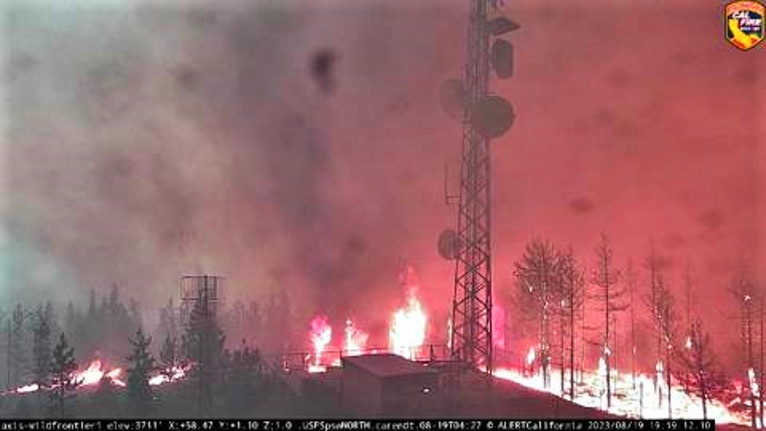
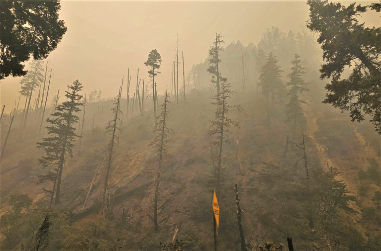
Fire authorities stated that afternoon thunderstorms in the area caused gusty erratic winds over portions of the fire and the Kelly fire made an uphill run to the Camp Six Lookout off the French Hill Road. Proactive fuels management around the communication towers and firefighter efforts successfully defended the critical infrastructure.
The Holiday fire and the northern portion of the Kelly fire continue to burn fuels between the two blazes drawing them closer together while the east side of the Kelly fire continues to back down Monkey Ridge towards U.S. Hwy. 199, north of the Idlewild Cal Trans station.
Conditions are expected to be cooler and moister as smoke conditions across the region continue as winds are expected to be calm throughout the day, however, adverse overnight conditions including dryer conditions and wind gusts of up to 30 mph, are expected to keep active burning late into the night.
There are currently 218 total resources and personnel on scene and resources requested by USFS are expected as additional resources continue to arrive at the incident.
Evacuation orders have been placed by the Del Norte County Sheriff’s Office, if you are in the area please sign up for their Community Alert System to receive emergency notifications. Evacuation levels as of 11:00 am, today August 20 are as follows:
Level 3 “Go Now”: Gasquet from Pioneer Road south to Slant Bridge Road, Patrick Creek, Little Jones Creek, Copper Creek Drainage, Coon Creek/ 16n19 17n07, Washington Flat, Pioneer Road, Panther Flat Campground Area, Sun Star Community and all other communities between Pioneer Road and the Oregon Border along Highway 199. – All of French Hill Rd.
Level 2 “Be Set”: High Divide, Rowdy Creek & Big Flat.
Level 1 “Be Ready”: French Hill, Low Divide, Hiouchi from Slant Bridge to the east end of North Bank Road.