


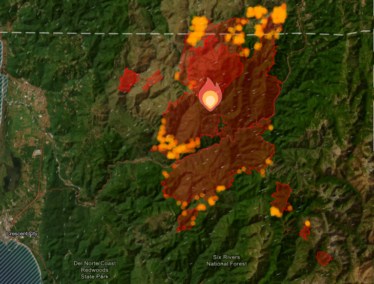
After Red Flag Warnings came to fruition inundating Oregon with over 1600 lightning strikes early in weekend, wind gusts and dry conditions drove fire activity in the Smith River Fire Complex, adding a modest 4,211 acres since Saturday morning, and now cover more than 70,716 acres with 6% containment.
Hard work and planning by fire crews and authorities worked to promptly contain threats to structures predesignated earlier in the week and prepared for protection from advancing flames as protecting as structures and keeping the fire from crossing the primary containment line is a top priority.
Direct and indirect fire lines northeast of the fire, south and west to Hwy 199 are being constructed and reinforced to minimize immediate threats to local communities and critical infrastructure.
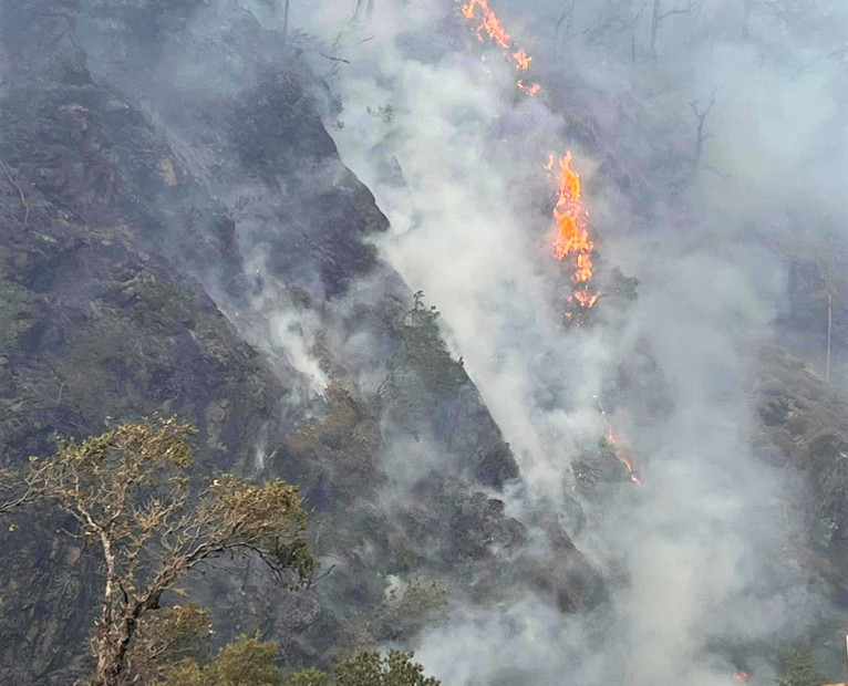
Patchy morning fog in the valleys and smoky conditions in the afternoons caused poor visibility conditions limiting air operations over the past few days.
Currently assigned resources include 2,250 total personnel, 51 crews, 5 helicopters, 234 engines, and 27 pieces of heavy equipment, and 9 Water Tenders with more resources requested and arriving at the Smith River Complex.
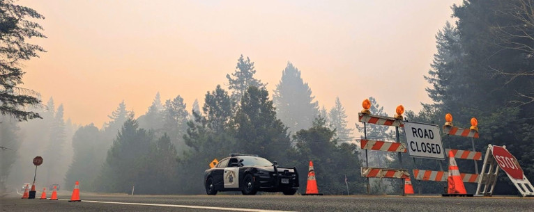
U.S. Hwy. 199 remains closed and the planned limited opening scheduled to begin Monday morning has been cancelled and has tentatively been postponed to Wednesday, August 30th.
The Del Norte County Sheriff’s Office, in collaboration with the County Office of Emergency Services and the California Interagency Incident Management Team 15, have lowered the evacuation level on Low Divide Road, from mile marker 1 to mile marker 13, to Level 2 (Be Set). Additionally, Rowdy Creek Road remains closed at the top, at its intersection with Low Divide Road.
Firefighters will remain in the area to continue prepping structures and lines, and residents are urged to remain vigilant as the evacuation level could be raised again if fire activity and conditions warrant such changes.
Level 3 “Go Now”: From Slant Bridge to the Oregon Border, including Gasquet, Patrick Creek, Little Jones Creek, Copper Creek Drainage, Coon Creek/16n19 17n07, Washington Flat, Pioneer Rd, Panther Flat Campground area, Sun Star Community, French Hill Road, and all other communities between Pioneer Road to the Oregon border.
Level 2 “Be Set”: “Be Set”: Rowdy Creek Road from approximately Mile Marker 3 (from Hwy 101) to approximately Mile Marker 6, Rock Creek & Big Flat
– The Low Divide area at Highway 197 from Mile Marker 1 to Mile Marker 13 (which is the intersection of Low Divide Road with Rowdy Creek Road).
Level 1 “Be Ready”: Hiouchi from Slant Bridge to the east end of North Bank Road