


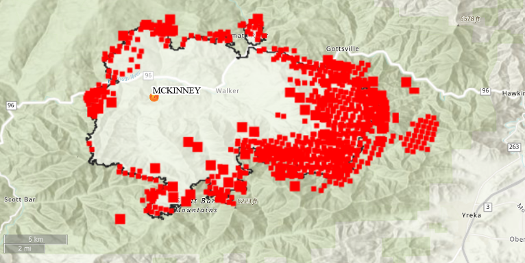
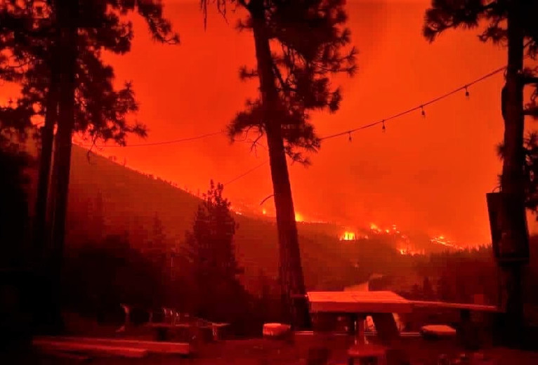
The McKinney fire in northern California’s Siskiyou County, has now ballooned to over approximately 52,498 acres as of late Sunday, July 31st, after first being reported just after 2:00pm, Friday afternoon, July 29th.
Smoke from the McKinney fire reached the coast Saturday and Sunday. Both Jackson and Josephine County’s are getting smoke and ash from the McKinney fire in Siskiyou County, however, there is no direct threat to our communities as well as no evacuations currently in Jackson County or in Josephine County.
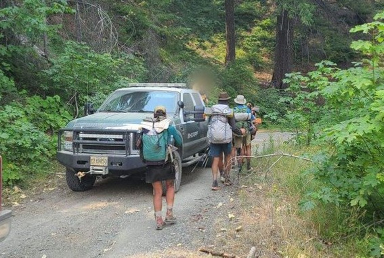
Evacuations for the McKinney fire in northern Siskiyou County included part of the Pacific Crest Trail and Jackson County Sheriff’s Office Search And Rescue as well as Rogue Valley Transportation District personnel assisted 60 people off the Pacific Crest Trail on the California side of the Red Buttes Wilderness Sunday afternoon.
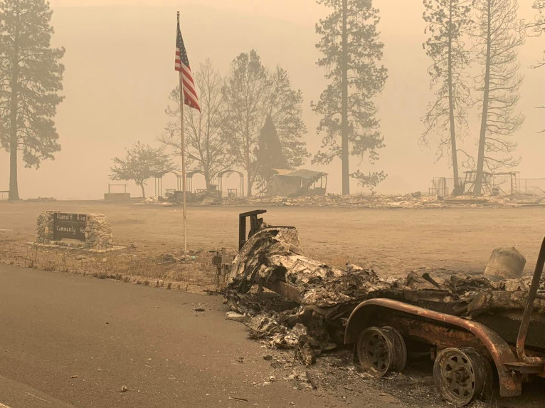
A heavy smoke inversion over the McKinney fire helped limit growth yesterday, however, it also kept aircraft mostly grounded. Crews are working above Fort Jones and west of Yreka to cut off the fire’s progress as well as working the China Fire, east of Seiad, last reported to be at 1,652 acres which has destroyed five structures.
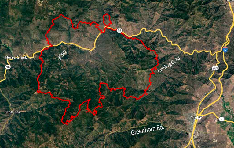
Communities northwest of Happy Camp to western Yreka remained under evacuation orders Sunday evening. Interstate 5, which runs through Yreka, remains open, however, Highway 96 remains closed from the junction of Highway 263, approximately two miles west of junction with Interstate 5, to Scott River Road, according to the California Department of Transportation.
Operations continue along the Highway 96 corridor, Beaver Creek community, and smaller communities from Hwy 5 to Horse Creek and Scott Bar and continues to move west towards Horse Creek and north into the 2014 Beaver Fire scar towards Round Mountain.