

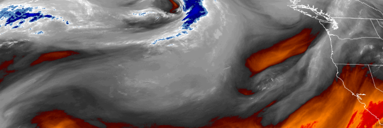
As the trough that has been circulating weather systems into the region moves slowly to the east, a ridge of high pressure is beginning to build off the Oregon coast, returning the area to a more regular summer weather pattern.
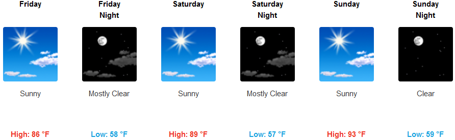
Skies are forecast to continue to clear, ushering warmer temperatures as the work week progresses with chances of triple digit temperatures by the end of the weekend and into the beginning of the next work week. Temperatures inland are expected to rise daily, ranging from the mid to upper 80’s Friday, to the low 100’s for afternoon highs to start the work week.
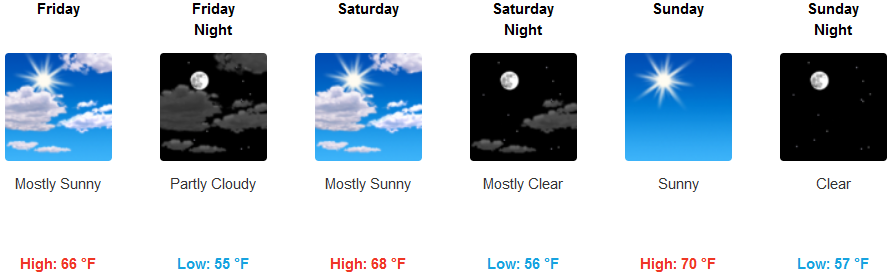
Along the coast, an early morning marine layer with localized fog will keep much of the coast cool, but temperatures are forecast to continue to warm under sunny afternoon skies, with mild temperatures in the upper 60’s for afternoon highs, getting to the low 80’s through the weekend.
Brookings:
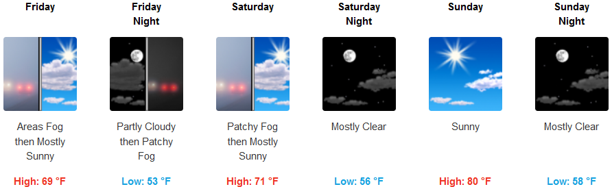
Crescent City:
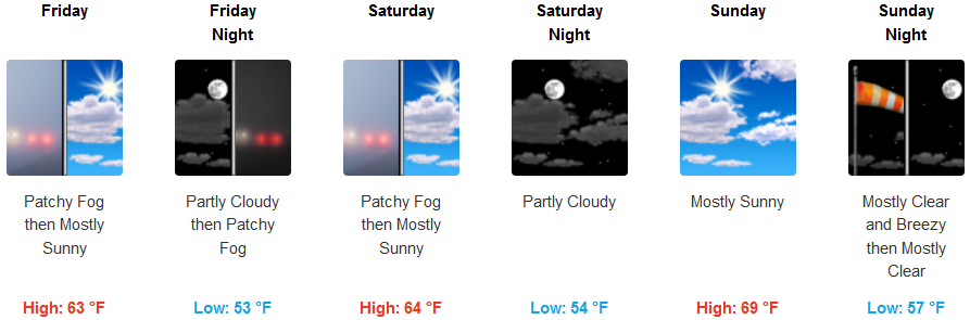
Gold Beach:
Cave Junction:
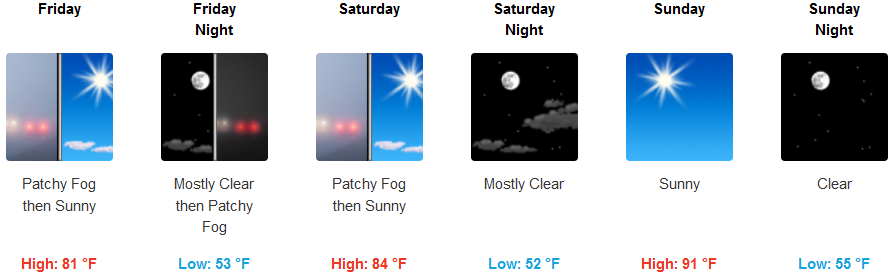
Grants Pass:
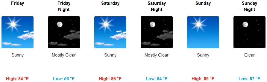
Medford: