

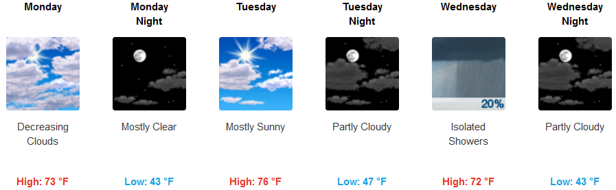
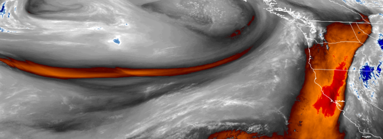
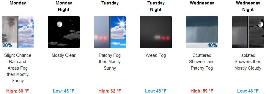
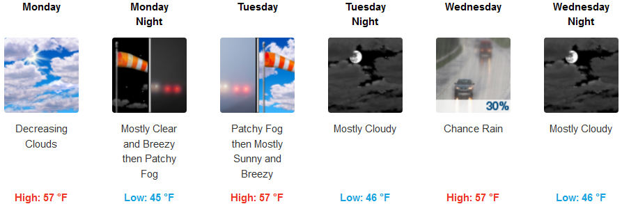
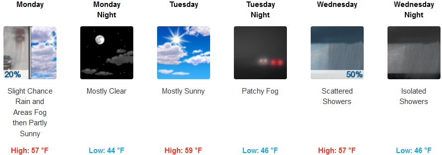
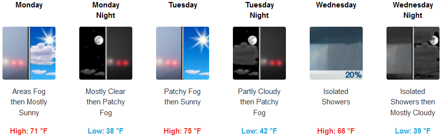
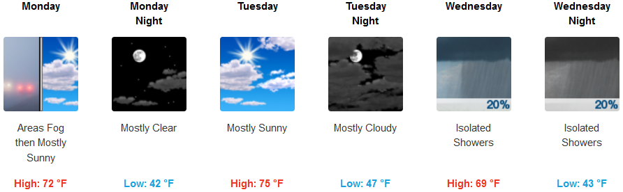
Unsettled weather is forecast to continue early in the work week as cold air from the north is pushing a pockets of precipitation onshore with showers continuing along the coast through Monday morning.
Partly cloudy skies are expected to Monday night and into Tuesday with localized patchy fog in the mornings, and breezy afternoons. Tuesday is forecast to be mostly sunny with a warming trend possibly raising temperatures to the mid 70’s inland. Temperatures along coastal areas will see warming into the mid 60’s before another system approaches Wednesday.
Brookings:
Crescent City:
Gold Beach:
Cave Junction:
Grants Pass:
Medford: