


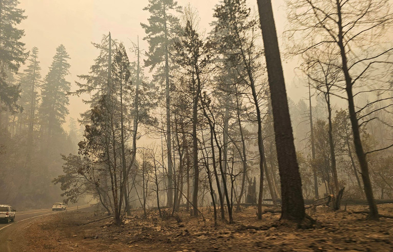
The Smith River Fire Complex experienced explosive growth in the past 24 hours now charring over 47,277 acres after burning through an incredible 16,885 acres since early yesterday with zero percent containment. U.S. Hwy. 199 remains fully closed in Del Norte County from Slant Bridge Road to Oregon Mountain Road and at the Agriculture Station near the Oregon border.
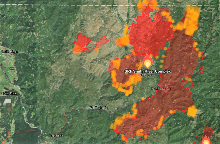
The fire has now stretched to within a mile of Panther Flat campground on the south side of U.S. Hwy. 199 and less than 2 miles from Panther Flat campground on the northside of U.S. Hwy. 199 as well as within 7 miles of the town of O’Brien. The fire has reached within 2 miles of the Collier Tunnel, 3 miles from Gasquet and just over 7 miles outside of Hiouchi as of Tuesday afternoon.
The west side of the Kelly fire moved into the North Fork Smith Roadless Area early yesterday after strong northeast winds affected the fire area overnight as areas of the Kelly fire made significant progress to the southwest growing approximately 2.5 miles in the early morning hours.
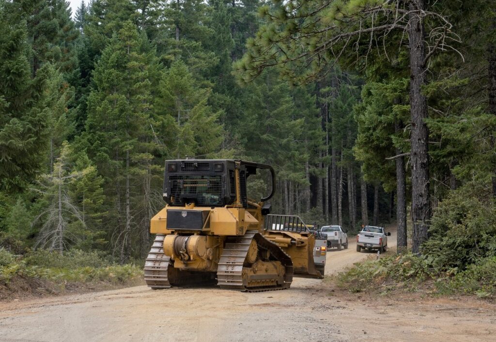
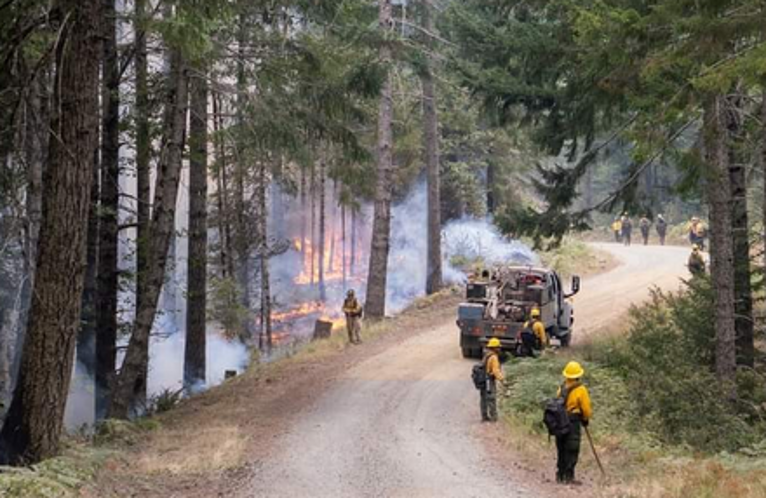
On the Smith River Complex North, Fire suppression efforts continue as on the Smith River Complex North as resources put in dozer line from Monkey Creek Ridge to Hwy 199 while other fire crews from the Northwest Incident Management Team cooperate with local fire departments conducting structure assessments,providing structure protection preparation plans in the event osignificant fire behavior threatens residences.

The Smith River Complex is under Temporary Flight Restrictions now extending to the north, into Oregon keeping privately-owned drone grounded for the safety of all assigned aerial resources working the Smith River Fire Complex.
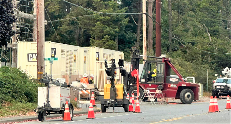
Wildfire activity continues to impact transmission lines forcing Pacific Power to de-energized its transmission lines serving the Crescent City, Hamburg and Scott Bar areas for the safety of the public and emergency responders. In coordination with the Del Norte County Emergency Operations Center, Pacific Power, has added additional generators that are providing power to approximately 4,000 customers in Crescent City and surrounding areas.
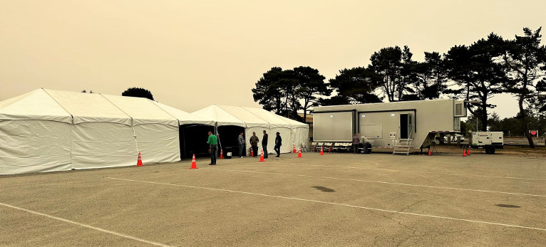
Community Resource Tents have been made available at the Del Norte High School Parking lot including charging stations where phones, tablets, and battery back ups can be charged. These tents also include a hose system installed by the City of Crescent City to fill buckets of water.
Also, the American Red Cross has opened a shelter at the Del Norte County Fairgrounds for those who have been impacted located at 421 US-101 N, Crescent City, CA. All evacuation orders are issued by the Del Norte County Sheriff’s Office. If you are in the Del Norte County, area please sign up for their Community Alert System to receive emergency notifications. Evacuation levels as of August 21st were
Level 3 “Go Now”: Patrick Creek, Little Jones Creek, Copper Creek Drainage, Coon Creek/ 16n19 17n07, Washington Flat, Pioneer Road, Panther Flat Campground Area, all communities between Slant Bridge Road north to the Oregon Border along Highway 199, French Hill Road.
Level 2 “Be Set”: High Divide, Rowdy Creek, Big Flat/Rock Creek
Level 1 “Be Ready”: Low Divide, Hiouchi from Slant Bridge to the east end of North Bank Road