


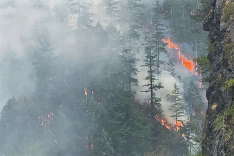
Monday, August 21st, saw another day of considerable growth along almost all of it’s expansive geographic area, but primarily to the south and west of the Smith River Complex, growing more than 5,000 acres in the past 24 hours.
The Pacific Northwest Incident Management Team 13 and the California Interagency Incident Management Team 15 will be working closely together to manage resources with the California Interagency Incident Management Team continuing fire suppression efforts south of the California/Oregon border and the Pacific Northwest Incident Management Team assigned to the northern reaches of the Complex.
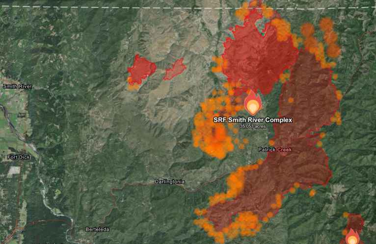
Now covering more than 30,392 total acres, it was feared Monday that Red Flag Warnings issued for strong, dry, northeasterly winds within the Smith River Complex could rapidly overcome communities, prompting new and extending existing evacuations including the community of Gasquet. Strong winds were confirmed at upper elevation remote weather stations, however, never surfaced along the Smith River corridor, keeping the fire at upper elevations.
Latest infrared flights have confirmed that the Holiday and Kelly fires have merged, and will be referred to as the Kelly Fire moving forward.
Highway 199 remains closed and Pacific Power reports that they continue to monitor wildfire activity impacting transmission lines and that customers should continue to prepare for multiple days without power as a restoration timeline is yet to be determined.
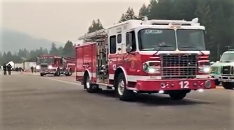
Tuesday, weather is predicted to be moderate with cooler temperatures as the 1,150 current personnel await additional resources, including six strike teams of both structure and wildland engines, continue to arrive to the incident. Additional engines and hand crews are expected to arrive over the next several days including law enforcement personnel from multiple jurisdictions to assist with incident safety and security.
The Corral and Diamond fires within the Smith River Complex are expected to merge and the now Kelly fire is expected to further impact transmission lines as it crosses the Oregon border to the north while continuing to impact U.S. Hwy 199.

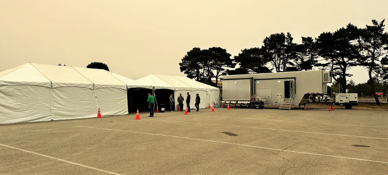
In coordination with Pacific Power, 2 Community Resource Tents have been made available at the Del Norte High School Parking lot including charging stations where phones, tablets, and battery back ups can be charged. These tents also include a hose system installed by the City of Crescent City to fill buckets of water.
Also, the American Red Cross has opened a shelter at the Del Norte County Fairgrounds for those who have been impacted located at 421 US-101 N, Crescent City, CA.
Evacuation orders have been placed by the Del Norte County Sheriff’s Office, if you are in the area please sign up for their Community Alert System to receive emergency notifications. Evacuation levels as of 11:00 am, today August 20 are as follows:
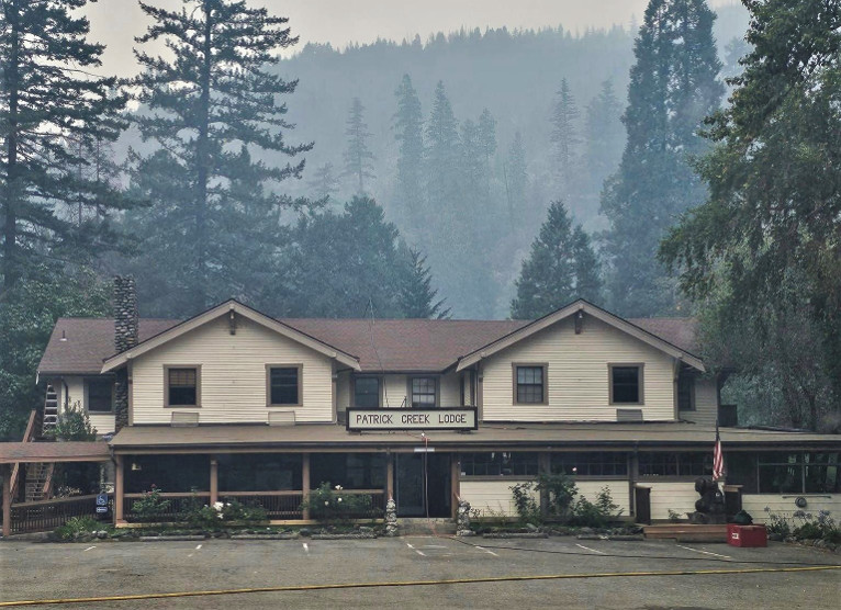
Level 3 “Go Now”: Patrick Creek, Little Jones Creek, Copper Creek Drainage, Coon Creek/ 16n19 17n07, Washington Flat, Pioneer Road, Panther Flat Campground Area, all communities between Slant Bridge Road north to the Oregon Border along Highway 199, French Hill Road.
Level 2 “Be Set”: High Divide, Rowdy Creek, Big Flat/Rock Creek
Level 1 “Be Ready”: Low Divide, Hiouchi from Slant Bridge to the east end of North Bank Road