

A cooler more unsettled weather pattern is forecast to move over the area bringing lower temperatures with increased chances of precipitation across the region through Thursday.
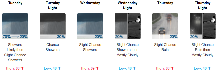
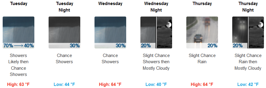
Inland areas should expect Tuesday morning showers slowing and clearing with a calm 5-6mph breeze into the afternoon. Chances of rain will return Tuesday night and continue through the work week. Temperatures will range from the mid to upper 40’s for lows, with highs getting into the upper 60’s.
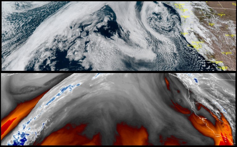
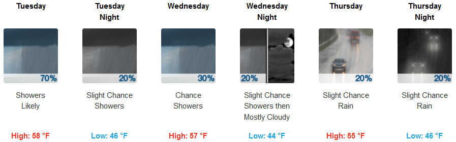
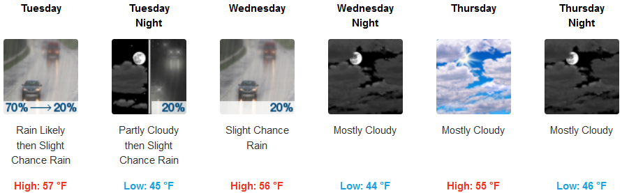
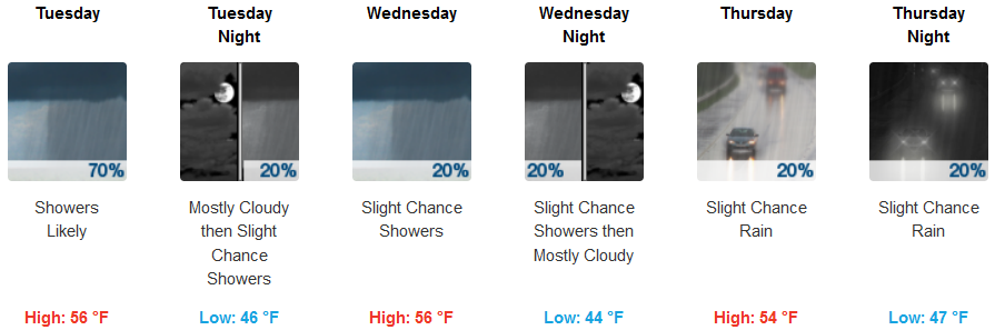
Along the coast, precipitation is possible for much of the work week, as the upper-level low circulates down the California coast. Rain should be expected everyday with the best chance for rain Tuesday with a light and variable wind. Temperatures are forecast to be in the mid 40’s for lows, with highs getting to the upper 50’s.
Brookings:
Crescent City:
Gold Beach:
Cave Junction:
Grants Pass:

Medford: