

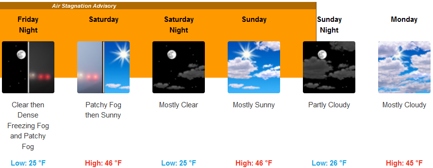
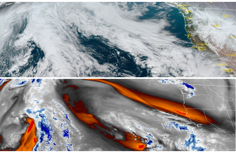
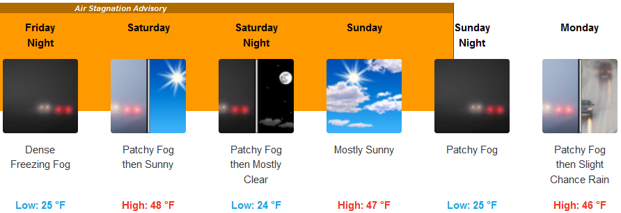
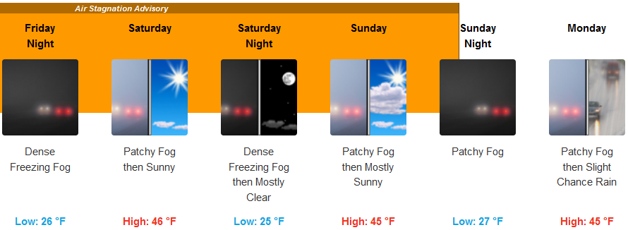
The ridge of high pressure and cold air that has circulated weather systems around the Pacific northwest for the past week and is responsible for the inversion layer that has prompted the National Weather Service to issue Air Stagnation Warnings across valleys of northern California, south central Oregon, and southwest Oregon, is expected to begin moving to the east ushering another round of wet weather to start the next week.
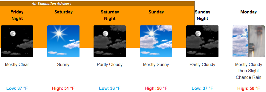
Inland areas can expect cold temperatures to continue to end the work week, however, not quite into the teens experienced in some areas this past week. Evening and early morning dense freezing fog is possible across much of the region. Precipitation is not expected this week as the ridge of cold air continues to bring partly cloudy to mostly sunny skies until very late Sunday as a wet weather system begins to move into the area. High temperatures will only reach the mid 40’s to low 50’s, with low temperatures dropping to the mid 20’s.
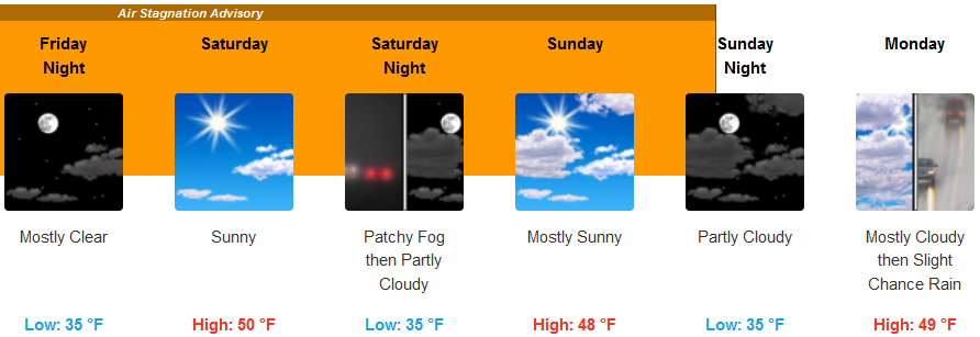
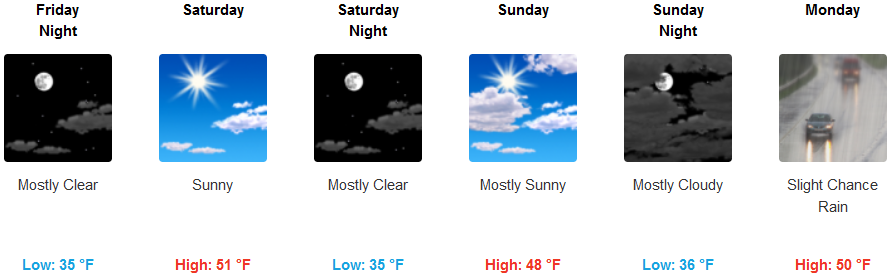
Along the coast, the previous forecast for frost advisories have been lifted by the National Weather Service, however, Air Stagnation Warnings have been extended to the coastline by the National Weather Service and for the immediate coastal areas through the weekend. Areas along the coast will continue to remain considerably warmer than areas inland as a change in the weather pattern is forecast to start next week. Mostly sunny skies will continue along the coast, continuing through the weekend with a slight chance of precipitation Monday with high temperatures reaching the upper 40’s to low 50’s and lows in the mid 30’s.
Brookings:
Crescent City:
Gold Beach:
Cave Junction:
Grants Pass:
Medford: