


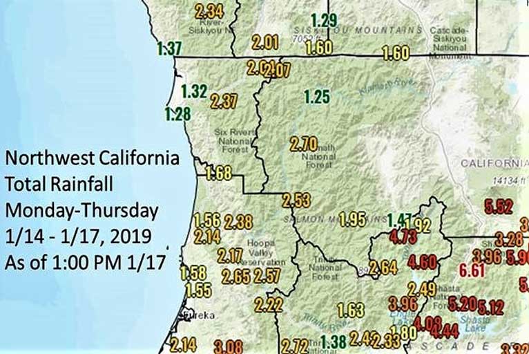
Another system will bring more rain to the region Friday into the weekend. This week many areas have received 2-4 inches of rain across Northwest California. The big winner since Monday is Honeydew California, where over 7 inches of rain has fallen.
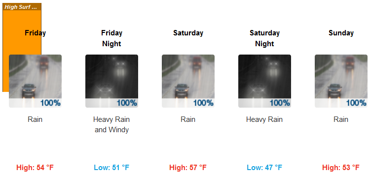
Following the showers Thursday and Thursday night, and the significant snowfall above 4000 feet over the past few days, another storm system is poised to impact the area this weekend, with more rain and much higher snow levels. After arriving Friday, the front is expected to stall across the area, placing a band of moderate to heavy rain across Josephine, Curry, and Siskiyou Counties for up to 48 hours.
Brookings:
Medford:
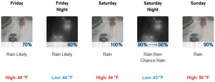
Total rainfall amounts through Sunday morning of 3 to 6 inches are expected in these areas, and localized amounts of up to 10 inches are possible. Meanwhile, snow levels will rise to above 7000 feet and remain there throughout the duration of heaviest rain.
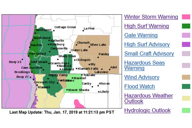
Due to the new rainfall and expected snowmelt, significant rises on area rivers and streams is possible, and ponding on area roadways is likely, but flooding is not expected at this time.
Please Like, Share and Follow the …
![]()