


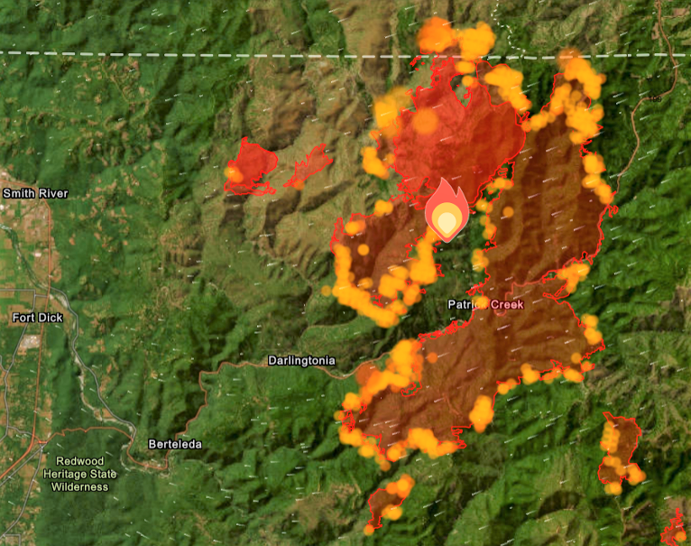
The latest imaging from the Smith River Fire Complex again indicates activity and growth in every sector and all along the perimeter now covering more than 52,716 total acres after adding more than 5,439 acres with still 0% containment. U.S. Hwy. 199 remains fully closed in Del Norte County from Slant Bridge Road to Oregon Mountain Road and at the Agriculture Station near the Oregon border.
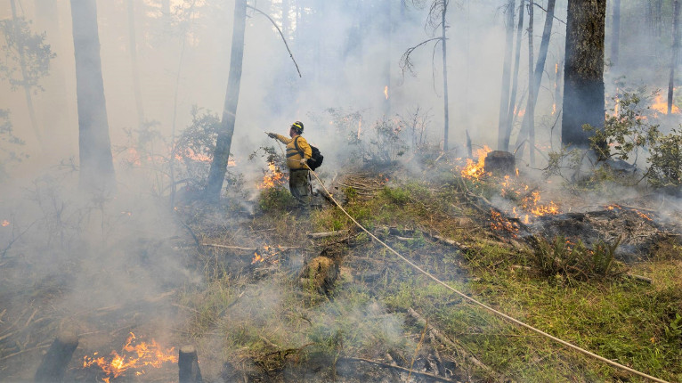
Fire Officials report the fire was pushed by gusty winds, spreading the Kelly Fire north into the West Fork of the Illinois River valley as local firefighters and resources from the Smith River Complex North concentrated on structure and powerline protection.
Smoke also made it difficult to monitor The fire’s spread and exact location has been difficult using aircraft due to dense smoke and aerial operations continue to be hampered by heavy smoke preventing helicopters from dropping water or retardant on the north edge of the Kelly Fire. Aerial resources are ready to support firefighters on the ground the moment weather conditions allow.
Currently assigned resources include seven helicopters for the Complex, nine engines, four crews, and five pieces of heavy equipment for the North, with more resources requested and arriving at the Smith River Complex.

Temporary generator power has reached approximately 8,000 customers with authorities hoping to have majority of Crescent City on temporary power by Saturday.
Community Resource Tents have been made available at the Del Norte High School Parking lot including charging stations where phones, tablets, and battery back ups can be charged. These tents also include a hose system installed by the City of Crescent City to fill buckets of water.

Also, the American Red Cross has opened a shelter at the Del Norte County Fairgrounds for those who have been impacted located at 421 US-101 N, Crescent City, CA.
All evacuation orders are issued by the Del Norte County Sheriff’s Office. If you are in the Del Norte County, area please sign up for their Community Alert System to receive emergency notifications. Evacuation levels as of August 21st were
Level 3 “Go Now”: From Slant Bridge to the Oregon Border, including Gasquet, Patrick Creek, Little Jones Creek, Copper Creek Drainage, Coon Creek, Washington Flat, Pioneer Rd, Panther Flat Campground area, Sun Star Community, French Hill Road, and all other communities between Pioneer Road to the Oregon border. including the Low Divide area at Highway 197 from Mile Marker 1 to Mile Marker 13 (which is the intersection of Low Divide Road with Rowdy Creek Road).
Level 2 “Be Set”: Rowdy Creek Road from approximately Mile Marker 3 (from Hwy 101) to approximately Mile Marker 6, Rock Creek, Big Flat
Level 1 “Be Ready”: Hiouchi from Slant Bridge to the east end of North Bank Road