

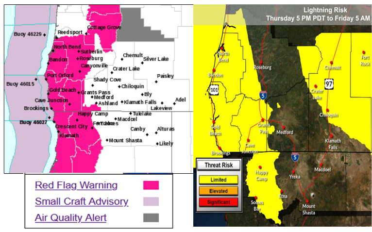
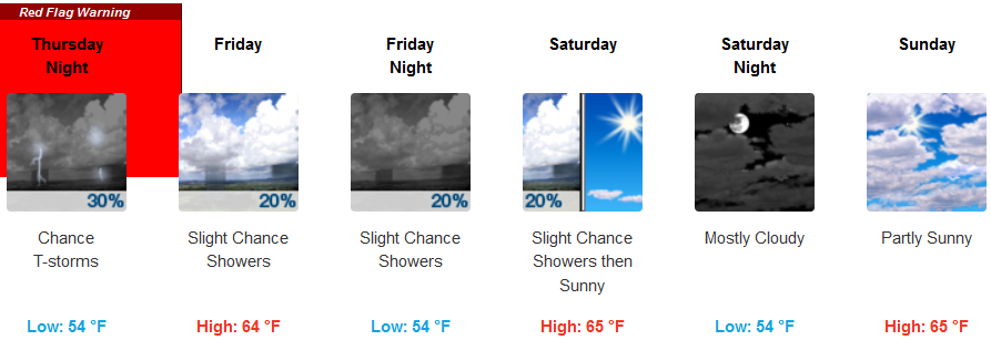
The National Weather Service has issued Red Flag Warnings for much of northwestern California and southwestern Oregon going into the weekend as temperatures remain high and risk for thunderstorms and lightning is expect Thursday evening into Friday morning.
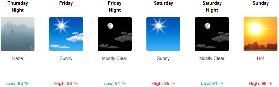
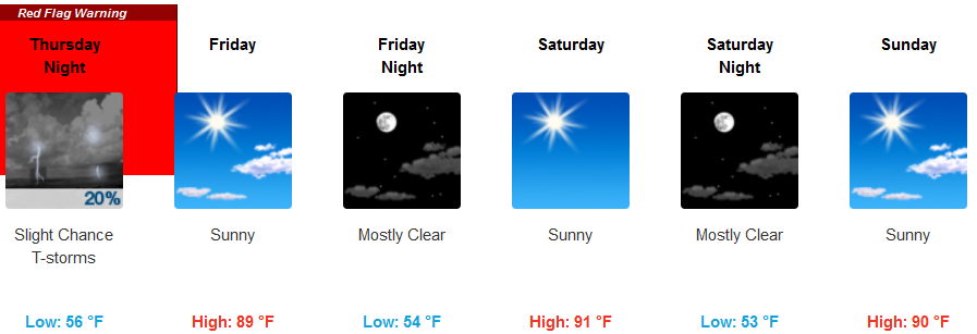
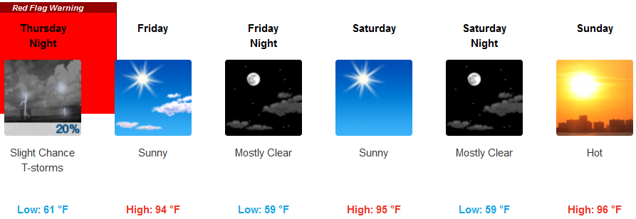
Inland areas and valleys are forecast to experience widespread smoke and haze Thursday before thunderstorms and lightning storms move into the region into Friday morning. Temperatures are expected remain very warm throughout with evening relief as lows only get into the low 60’s. Afternoon highs are expected to be in the mid 90’s as the work week ends, warming to the upper 90’s over the weekend.
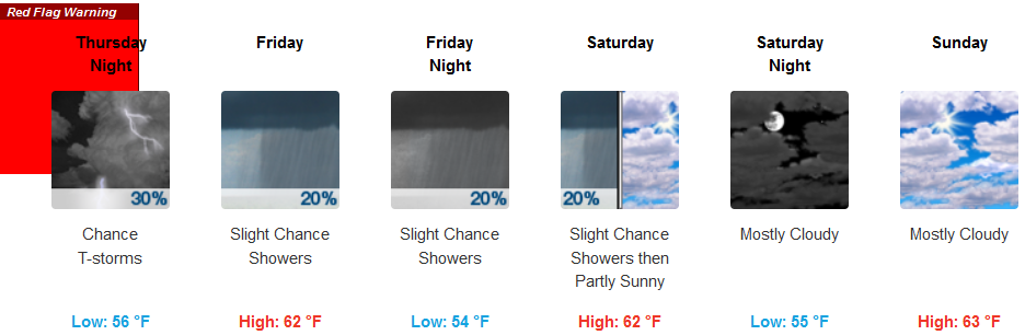
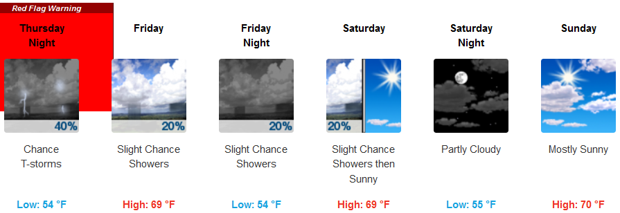
The coast is also included in the Red Flag Warnings issued by the National Weather Service with chances of dry lightning and thunder storms possible into Friday morning. Haze and smoke under partly cloudy skies will keep temperatures warm along the coast, cooling slightly as week ends and slowly warming back into the low 70’s for possible afternoon highs as into the weekend.
Brookings:
Crescent City:
Gold Beach:
Cave Junction:
Grants Pass:
Medford: