

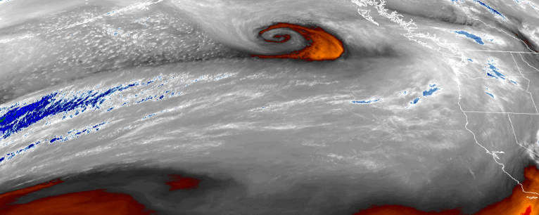
The stubborn dome of high pressure that dominated the weather cycle pushing weather systems and precipitation to consistently to north over the past week, has weakened and pushed to the south and east, allowing the jet stream to dip down to northern California, sparking high surf advisories along the coast, and wind warnings inland.
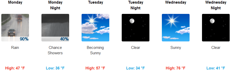
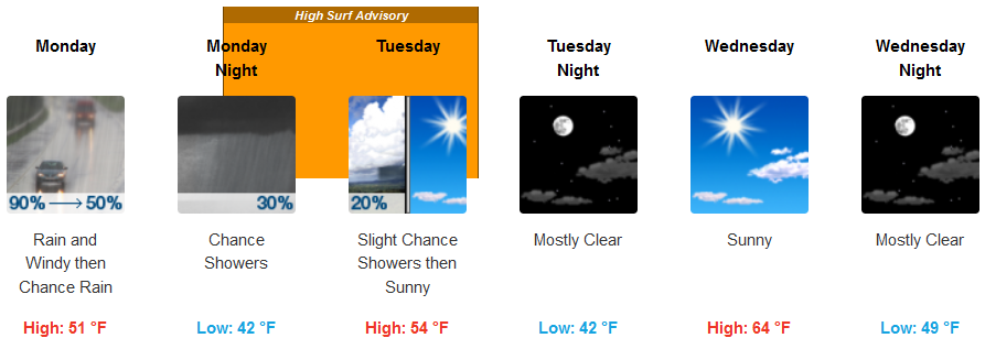
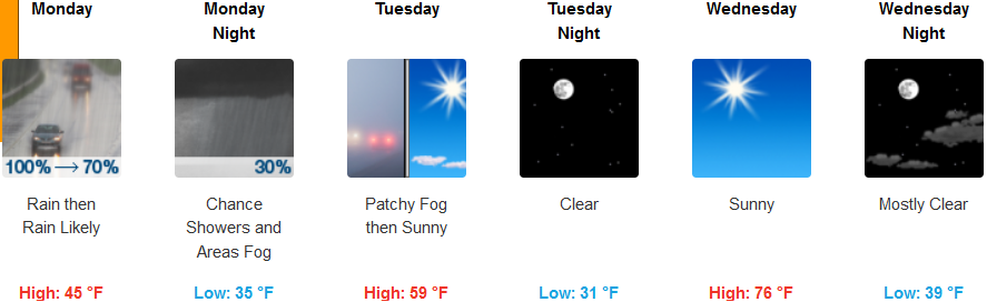
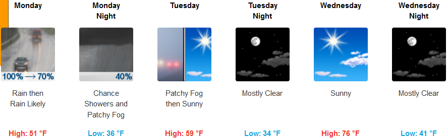
Areas away from the coast and inland are forecast to see much needed rainfall in the region through Monday, with relatively high snow levels, however, heavy and blowing mountain snow is forecast to impact areas east of the valley in with a Winter Weather Advisory in effect. Temperatures are expected to stay relatively warm, keeping snow levels high, with early morning lows in the mid to upper 30’s and highs in the mid 50’s before warming by mid week.
Along the coast, rain is forecast late Sunday or very early Monday morning, with wind gusts up to 45 mph in some areas, creating Gale Warnings and High Surf Advisories all along the Oregon and northern California coastlines. Again, temperatures are forecast to remain mild, with highs in the mid 50’s going into mid week, and lows hovering in the mid 40’s.
Brookings:
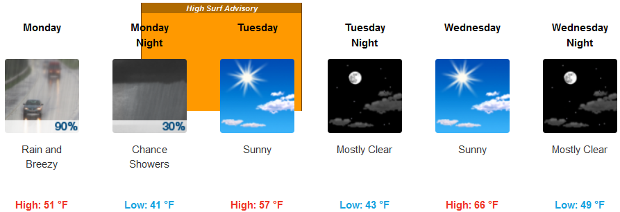
Crescent City:
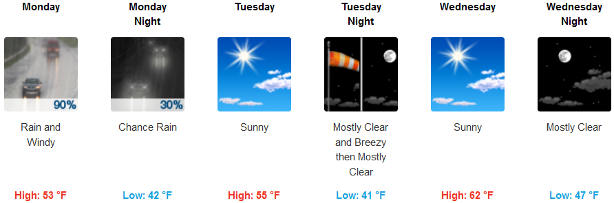
Gold Beach:
Cave Junction:
Grants Pass:
Medford: