

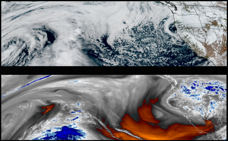
The low pressure system off the northern California coast is expected to continue to bring chances of rain possible across much of the region with brief localized downpours and thunderstorms to start the workweek and more significant chances of precipitation as the week progresses.
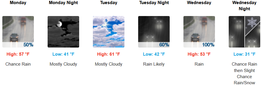
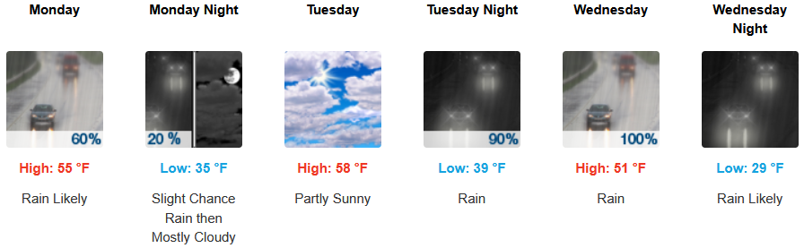
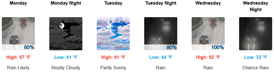
An unsettled airmass is expected for inland areas to start the week with partly cloudy skies, chances of rain, with brief localized downpours and thunderstorms before clouds increase into Tuessday evening with rain forecast into midweek. Afternoon highs will end the week in the mid to upper 50’s, with lows forecast to be in the low to mid 40’s.
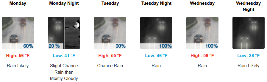
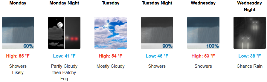
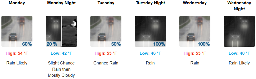
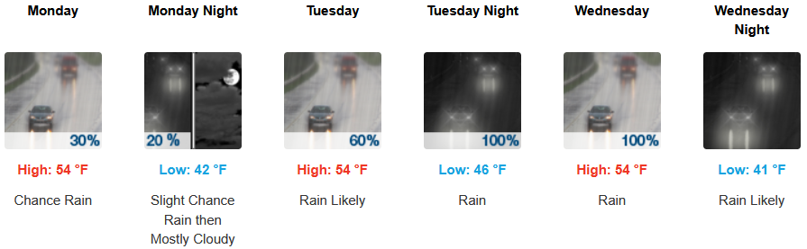
Along the coast, rain is in the forecast everyday to start the workweek as unsettled air continues to circulate onshore with isolated areas of rain before another weather system pushes over the area as early as Tuesday. Highs are expected to be in the low to mid 50’s, with lows forecast to be in the mid to upper 40’s.

Brookings:
Crescent City:
Gold Beach:
Port Orford:
Cave Junction:
Grants Pass:
Medford: