

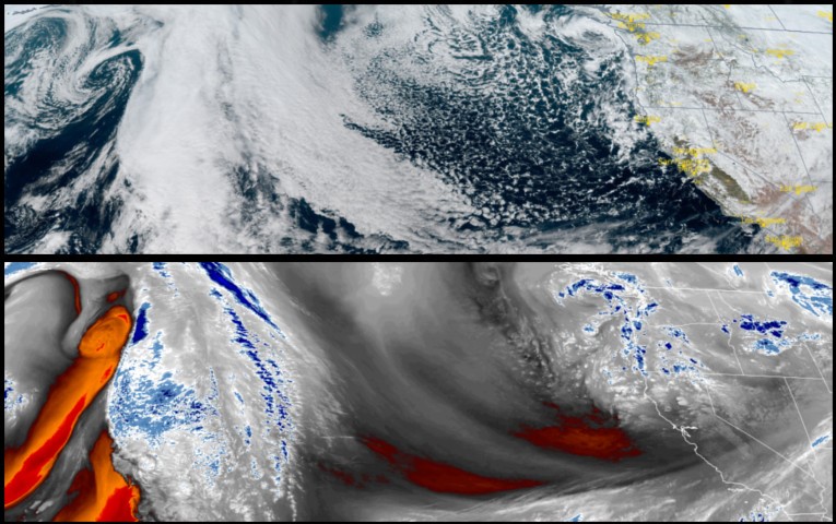
Showers, snow and hail are forecast to continue through Tuesday and into Wednesday as a cold unsettled air mass continues to circulate through the area. The National Weather Service continues Winter Storm Warnings and and Winter Weather Advisories over southwest Oregon and northern California.
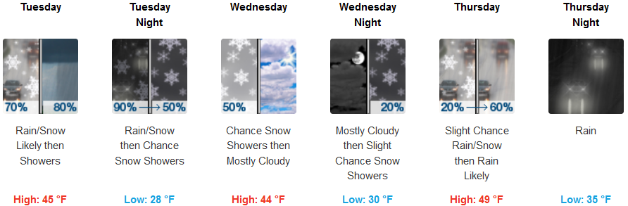
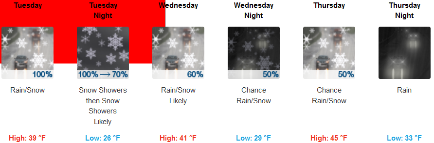
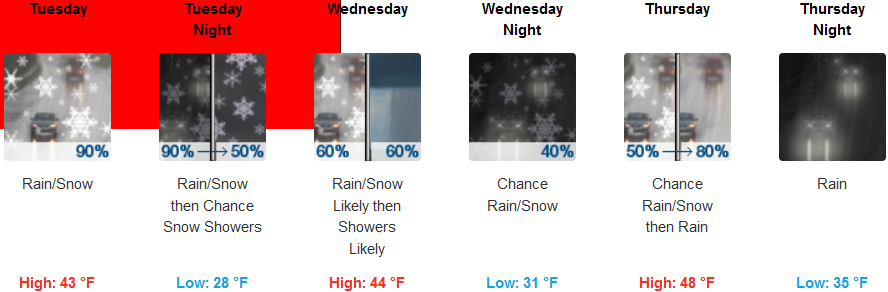
Unsettled weather conditions are forecast for inland areas with localized heavy snow possible through Wednesday. Cold temperatures will continue to bring snow levels between 1000ft. and 2000ft. with accumulations of 1 to 2ft. expected. Afternoon highs are only expected to reach the low 40’s with early morning lows hovering in the in the upper 20’s and low 30’s.
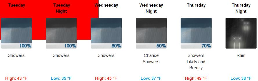
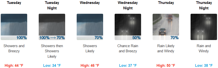
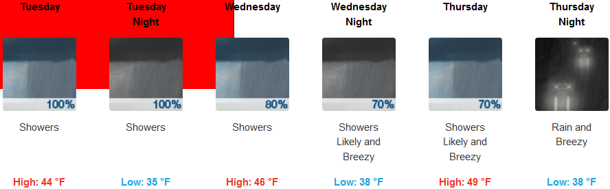
Along the coast rain and localized hail and snow flurries are forecast for the remainder of the work week. Rain and thunderstorms are forecast through the week with a steady wind gusting to 20mph. Snow levels will be between 1200 to 1500ft with snow expected on most passes throughout the week. Highs will get into the low to mid 40’s, while early morning lows could drop to the mid 30’s.
Brookings:
Crescent City:
Gold Beach:
Cave Junction:
Grants Pass:
Medford: