

Recent weather systems have signaled the beginning of a change as patterns shift, pushing fronts across the central west coast, bringing increased opportunities for above normal levels of precipitation.
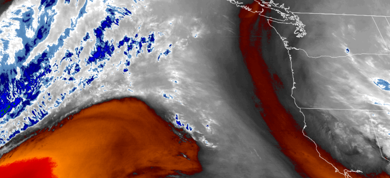
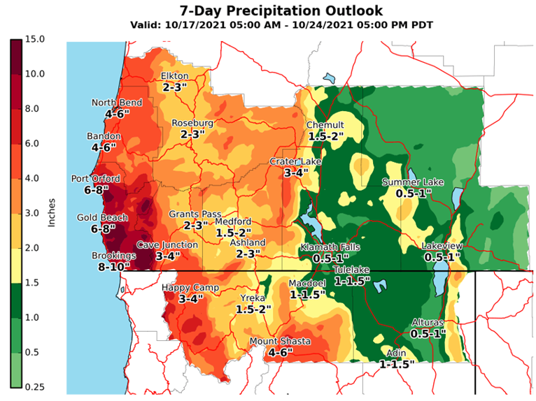
Above average levels of precipitation are forecast after a short break from latest system. Across the region, localized precipitation is forecast through Monday morning, clearing to partly cloudy skies with the possibility of localized showers late Monday evening and rain beginning Tuesday, possibly increasing to larger accumulations through mid-week.
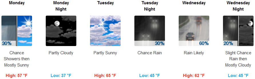
Inland, to begin the work week, Monday morning is forecast to see showers tapering off as the day progresses, clearing to partly cloudy skies before another system moves into the area late Tuesday evening. Temperatures are expected to warm slightly to the low to mid 60’s by mid-week, with lows in the mid 40’s.
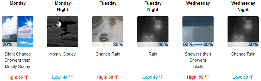
On the coast, expect a slight chance of localized showers early clearing to partly cloudy skies before the next system arrives late Monday night bringing showers Tuesday morning increasing to rain with the possibility of significant accumulations by mid-week. Temperatures are forecast to remain relatively mild with early morning lows in the upper 40’s to low 50’s and high temperatures in the mid 50’s.
Brookings:
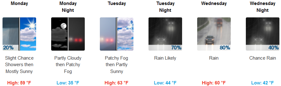
Crescent City:
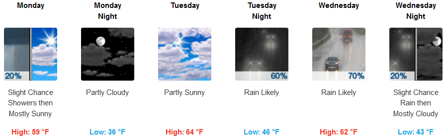
Gold Beach:
Cave Junction:
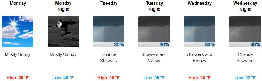
Grants Pass:
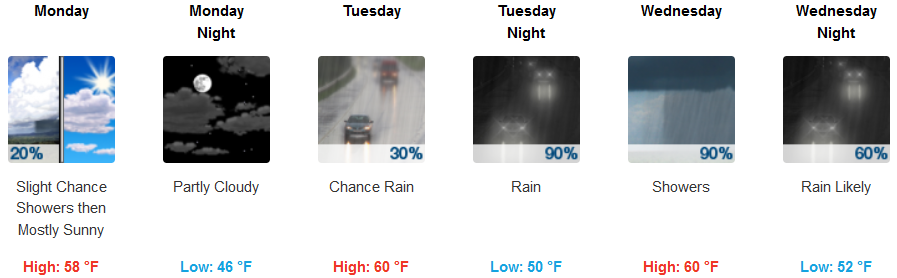
Medford: