

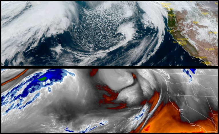
After a sequence of relatively dry cool weather for the past few days, a weak trough is expected to quickly sweep across the region Friday morning bringing a quick round of light rain. Behind this weak front, colder air will move into the area Friday and with it the possibility of more rain as another system approaches.
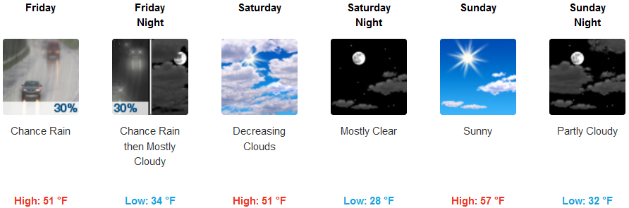
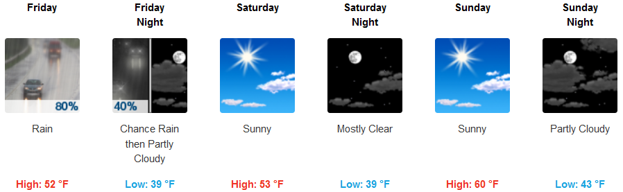
Inland areas can expect a slight chance for precipitation by mid morning Friday, continuing into late Friday evening before gradually becoming mostly sunny Saturday as a colder air mass moves into the region dropping snow levels to 3300 ft. Sunday is forecast to be mostly sunny, with a system working its way into the valley and higher elevations Monday. Temperatures are expected to be cool, getting colder Monday as the new system establishes itself. Lows will start mid 30’s Friday, dropping to the upper 20’s going into Monday, with highs in the mid 50’s.
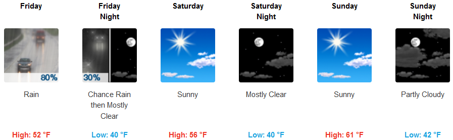
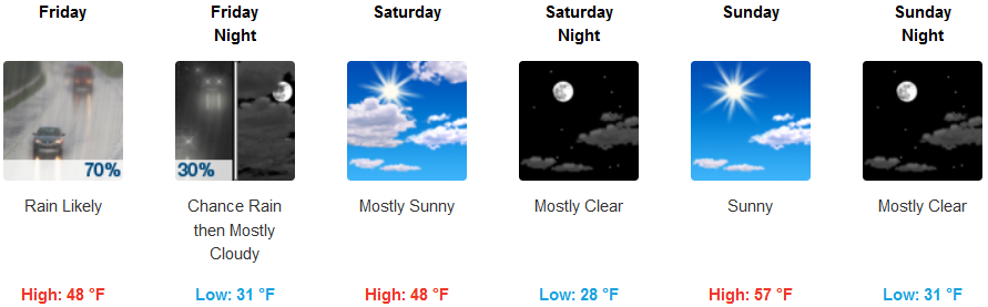
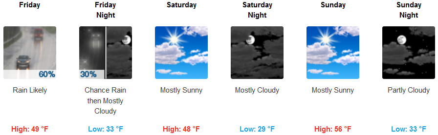
Coastal areas will have a significant chance of showers Friday after the initial round of precipitation Thursday evening, before clearing late Friday evening ushering in a Sunny, relatively warm Saturday. The next chance for rain will come Monday as a system to the south circulates wet weather into the region. This system will bring a cold air mass moving into Monday with another chance for precipitation. Temperatures will in the low 40’s for morning lows with afternoon highs reaching the low 50’s.
Brookings:
Crescent City:
Gold Beach:
Cave Junction:
Grants Pass:
Medford: