

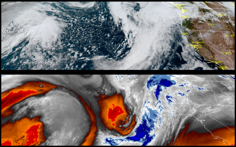
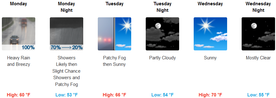
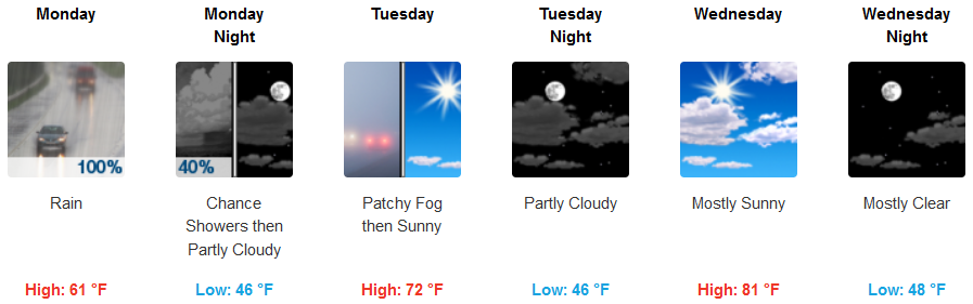
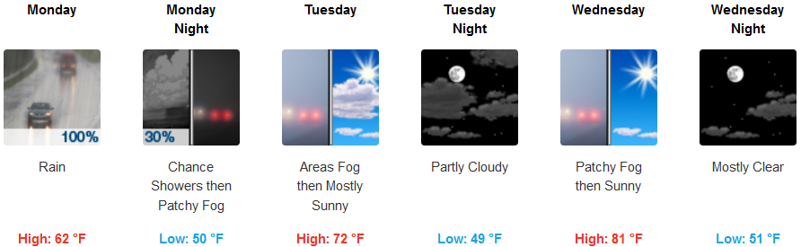
Another cold front is poised to move over the region beginning Monday morning bring significant chances for precipitation across northern California and southern Oregon with again coastal areas and coastal mountain ranges experiencing more accumulation.
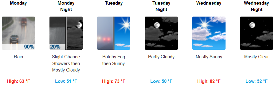
Interior areas are forecast to experience rain Monday, dissipating late Monday evening bringing localized fog Tuesday morning and clearing skies in the afternoon before becoming partly cloudy and warmer later in the work week. Morning lows are expected to be in the low 50’s with highs ranging from the low 60’s to start the week to the upper 70’s by mid week.
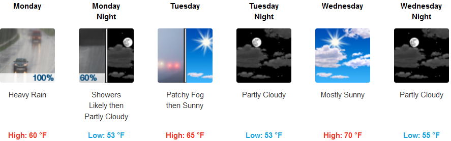
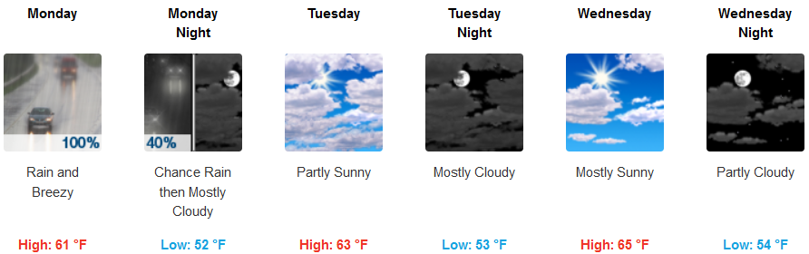
Along the coast, rain, heavy at times is forecast for Monday, with a south wind gusting up to 28mph, with showers expected to extend into Tuesday morning, developing into localized fog and partly cloudy skies Tuesday and warming slightly into Wednesday. Low temperatures will hove in the mid 50’s as afternoon highs warm into the upper 60’s.
Brookings:
Crescent City:
Gold Beach:
Cave Junction:
Grants Pass:
Medford: